
Lumaktaw sa nilalaman
Ngayon

UmuusadAraw 6

The Port-Olry earthquake

  1. Update 2 sa 2PinakabagoAraw 6Pagkalipas ng 4 araw

    Vanuatu quake’s low-impact forecast leaves local damage and coastal guidance unclear

    Initial assessments point to low humanitarian impact after the October 24 offshore earthquake, but local damage and current coastal-safety guidance remain unconfirmed.
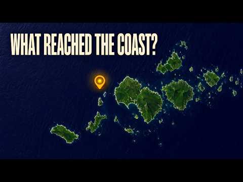
    Manood

    The Watchers

    • EarthquakeTracker lists a magnitude-5.1 mww earthquake 203 kilometres northwest of Port-Olry.
    • A separate listing places a magnitude-4.5 mb earthquake 195 kilometres northwest of Port-Olry.
    • The reviewed magnitude-6.3 mb earthquake strikes 170 kilometres northwest of Port-Olry.
    • EarthquakeTracker lists a magnitude-5.1 mb earthquake 170 kilometres northwest of Port-Olry.
    • A magnitude-5.2 mb earthquake is listed 202 kilometres northwest of Port-Olry.
  2. Update 1 sa 2Araw 1

    Magnitude 6.3 quake strikes offshore Vanuatu; impacts still unclear

    The reviewed quake struck 204 kilometres west-northwest of Port-Olry. Early catalog entries establish neither a tsunami warning nor an all-clear on damage.

    Manood

    USGS

    • 6.3Reviewed earthquake magnitude
    • 10 kmRecorded depth
    • 204 kmWest-northwest of Port-Olry

Sino ang nag-ulat

Sino ang nag-ulat

34 outlet · 86 sanggunian

8 sa 34 ang nakapag-ulat na sa puntong ito

Sino ang nag-ulat ng ano

Mga puntong iniulat ng higit sa isang outlet

Mga puntong iniulat ng iisang outlet lang10

Iniulat lang ng USGS

Iniulat lang ng GDACS

Iniulat lang ng Latest news from Azerbaijan

Bawat linya ay ang pahayag ayon sa naitala namin mula sa ulat ng outlet na iyon. Inihambing hanggang .

Kronolohiya

Kronolohiya

Araw 6 · 2 ulat

  1. Unang nag-ulat

  2. Makalipas ang 4 na araw

  3. EarthquakeTracker lists a magnitude-5.1 mww earthquake 203 kilometres northwest of Port-Olry.

  4. A separate listing places a magnitude-4.5 mb earthquake 195 kilometres northwest of Port-Olry.

  5. The reviewed magnitude-6.3 mb earthquake strikes 170 kilometres northwest of Port-Olry.

  6. EarthquakeTracker lists a magnitude-5.1 mb earthquake 170 kilometres northwest of Port-Olry.

  7. A magnitude-5.2 mb earthquake is listed 202 kilometres northwest of Port-Olry.

Kasaysayan

  1. Binuksan1 ulat

  2. Isinama ang The October 24 Port-Olry earthquake1 ulat

    Both charters describe the same October 20, 2026 Port-Olry earthquake, with matching magnitude and location; the October 24 Port-Olry quake is explicitly excluded and is a separate event.

Sino ang sangkot

Sino ang sangkot

Mga organisasyon

  • United States Geological Surveyscientific agency of the United States government

Mga lugar

  • Port Olry
  • Vanuatu

Kaugnay na coverage

Kaugnay na coverage

  1. Parehong pangyayariVanuatu tsunami warning lifted after magnitude 6.9 quake and repeated shocks
Vanuatu quake’s low-impact forecast leaves local damage and coastal guidance unclear