
Langsung ke konten
Sekarang

Sedang berkembangHari ke-6

The Port-Olry earthquake

  1. Pembaruan 2 dari 2TerbaruHari ke-64 hari kemudian

    Vanuatu quake’s low-impact forecast leaves local damage and coastal guidance unclear

    Initial assessments point to low humanitarian impact after the October 24 offshore earthquake, but local damage and current coastal-safety guidance remain unconfirmed.
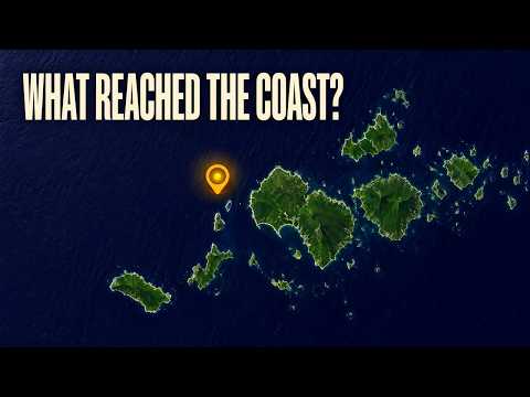
    Tonton

    The Watchers

    • EarthquakeTracker lists a magnitude-5.1 mww earthquake 203 kilometres northwest of Port-Olry.
    • A separate listing places a magnitude-4.5 mb earthquake 195 kilometres northwest of Port-Olry.
    • The reviewed magnitude-6.3 mb earthquake strikes 170 kilometres northwest of Port-Olry.
    • EarthquakeTracker lists a magnitude-5.1 mb earthquake 170 kilometres northwest of Port-Olry.
    • A magnitude-5.2 mb earthquake is listed 202 kilometres northwest of Port-Olry.
  2. Pembaruan 1 dari 2Hari ke-1

    Magnitude 6.3 quake strikes offshore Vanuatu; impacts still unclear

    The reviewed quake struck 204 kilometres west-northwest of Port-Olry. Early catalog entries establish neither a tsunami warning nor an all-clear on damage.

    Tonton

    USGS

    • 6.3Reviewed earthquake magnitude
    • 10 kmRecorded depth
    • 204 kmWest-northwest of Port-Olry

Yang melaporkan

Yang melaporkan

34 media · 86 sumber

6 dari 34 telah melaporkan hingga saat ini

Siapa melaporkan apa

Poin yang dilaporkan lebih dari satu media

Poin yang hanya dilaporkan satu media10

Hanya dilaporkan oleh USGS

Hanya dilaporkan oleh GDACS

Hanya dilaporkan oleh Latest news from Azerbaijan

Setiap baris adalah klaim sebagaimana kami catat dari laporan media tersebut. Dibandingkan per .

Linimasa

Linimasa

Hari ke-6 · 2 laporan

  1. Pertama melaporkan

  2. 4 hari kemudian

  3. EarthquakeTracker lists a magnitude-5.1 mww earthquake 203 kilometres northwest of Port-Olry.

  4. A separate listing places a magnitude-4.5 mb earthquake 195 kilometres northwest of Port-Olry.

  5. The reviewed magnitude-6.3 mb earthquake strikes 170 kilometres northwest of Port-Olry.

  6. EarthquakeTracker lists a magnitude-5.1 mb earthquake 170 kilometres northwest of Port-Olry.

  7. A magnitude-5.2 mb earthquake is listed 202 kilometres northwest of Port-Olry.

Riwayat

  1. Dibuka1 laporan

  2. Menyerap The October 24 Port-Olry earthquake1 laporan

    Both charters describe the same October 20, 2026 Port-Olry earthquake, with matching magnitude and location; the October 24 Port-Olry quake is explicitly excluded and is a separate event.

Siapa yang terlibat

Siapa yang terlibat

Organisasi

  • United States Geological Surveyscientific agency of the United States government

Tempat

  • Port Olry
  • Vanuatu

Liputan terkait

Liputan terkait

  1. Peristiwa yang samaVanuatu tsunami warning lifted after magnitude 6.9 quake and repeated shocks
Magnitude 6.3 quake strikes offshore Vanuatu; impacts still unclear