Disasters · Puerto Rico flooding
San Juan-area flash flood warning follows heavy rain
The alert covered San Juan, Trujillo Alto and northern portions of Carolina and Guaynabo. Its original 4:15 p.m. AST deadline does not establish its later status.
Transcript · LOADING
Story trackerDay 1
1 report9 outlets15 sources
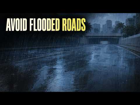
A flood warning marks a consequential turn in a rainstorm: the concern is no longer just how much rain falls, but where the water goes. Around San Juan on October 19, 2026, forecasters warned that heavy rain threatened streets, waterways and low-lying areas, with flash flooding already occurring or expected to begin shortly. 1
The National Weather Service in San Juan issued the warning at 1:28 p.m. Atlantic Standard Time for northern Carolina, northern Guaynabo, San Juan and Trujillo Alto, Puerto Rico. Its original scheduled expiration was 4:15 p.m. AST that afternoon. A subsequent extension, replacement or cancellation has not been independently verified, so that deadline should not be read as confirmation of the warning’s current status. 1
For people traveling through the named areas, the immediate instruction was straightforward: do not drive through flooded roads. The agency also asked people to report flooding, but only when they could do so safely. Those instructions did not depend on a confirmed damage count or a list of closed streets. 1
What the rainfall figures establish
At issuance, Doppler radar indicated thunderstorms producing heavy rain across the warned area. Forecasters estimated that between 1 and 2 inches had already fallen, with another 1 to 2 inches possible. The first range was the warning’s assessment of rain already received; the second was a forecast, not an additional measured accumulation. 1
That distinction matters when judging the scale of the event. Adding the two ranges together would not establish how much rain ultimately fell. Nor should the estimate be presented as an independently verified rain-gauge total. It describes the conditions and potential for further rain assessed when the warning was issued. 1
The warning identified small creeks and streams, urban areas, highways, streets, underpasses and other poorly drained or low-lying places as locations where flooding could have an impact. This was a description of threatened settings, not a verified inventory of places already underwater. No particular street or property was established as flooded by the radar indication alone. 1
The geographical wording is equally important. The alert covered the northern portions of Carolina and Guaynabo, alongside San Juan and Trujillo Alto. It did not place all of Carolina, all of Guaynabo or all of Puerto Rico under this warning. Anyone using the municipality names as a shorthand needs to preserve those northern-only limits. 1
The deadline is not an all-clear
The original warning provided a specific afternoon window, beginning at 1:28 p.m. and scheduled to end at 4:15 p.m. AST. That establishes what forecasters issued, but not what a later bulletin may have changed. Without a matching update, it would be wrong either to declare the warning extended or to say it had ended as scheduled. 1
An available National Weather Service San Juan webpage snapshot displayed no watches, warnings or advisories, but its update time was 12:52:20 p.m. AST—before this warning was issued. That earlier page cannot resolve the later alert’s status. The timing of a weather update is part of its meaning, not a minor detail. 3
Known
- The original warning named four municipalities or portions of them and identified radar-indicated heavy rain as its basis. 1
Unknown
- Whether a later bulletin changed the warning’s duration or boundaries remains unverified. There are also no verified incident details establishing closures, rescues, damage or injuries in the warning area.
Next
- A matching warning update and dated local impact reports would establish how the threat developed after issuance.
The absence of verified incident details is not evidence that no flooding occurred. The Weather Service’s language explicitly allowed for flooding already underway, as well as flooding expected shortly. But that warning cannot responsibly be turned into a confirmed account of damaged homes, stranded motorists or injuries without supporting reports. 1
The practical distinction is between taking a threat seriously and overstating what has happened. Residents and travelers were given a clear reason to avoid flooded roads. What remains unresolved is how the rain translated into actual disruption—and whether the original afternoon warning window was subsequently changed.
As aired 10 lines
- Thunderstorms dropped one to two inches of rain around San Juan.
- That radar-based estimate came with a flash flood warning for four municipalities. Forecasters warned that flooding was already occurring or could begin shortly, threatening roads and low-lying areas.
- Residents need to know where the threat reaches and whether the warning's afternoon deadline still holds.
- Northern Carolina and northern Guaynabo were included, along with San Juan and Trujillo Alto. The warning covered those named areas in Puerto Rico. For Carolina and Guaynabo, the boundaries specifically covered their northern portions.
- The warning was issued October nineteenth. Radar detected thunderstorms producing heavy rain across the area, and forecasters warned that more rain could follow.
- Forecasters estimated one to two inches had already fallen, with another one to two inches possible. The additional rain was a forecast. Those amounts describe conditions and expectations when the warning was issued.
- Urban areas were among the places at risk. Water could also affect small creeks and streams, highways, streets and underpasses. Poorly drained and low-lying places were specifically threatened.
- The radar signal drove the warning. It doesn't tell residents which particular street or property has flooded.
- The warning's original scheduled expiration was four fifteen that afternoon, Atlantic Standard Time. Whether a later bulletin extended, replaced or cancelled it isn't yet confirmed. That deadline alone doesn't tell residents whether the warning still applies.
- For travelers, the instruction is direct. Don't drive through flooded roads. If you encounter flooding, report it only when it's safe to do so.
Sources
15 sources9 outlets
GOES Image Viewer - NOAA/NESDIS/STAR websitenoaa.gov1
Iowa Environmental Mesonetiastate.edu1
Latin Postlatinpost.com1
Primera Horaprimerahora.com1First
Warning Vectorwarningvector.com1
- First reported
- Flood Advisory
Weather Alert Watchanerg.com1
- First reported
- Coastal Flood Advisory for Pamlico; Southern Craven
Source map
Follow the evidence behind this report. The map shows its connections; the links below open the sources cited in this article.
Source map loads as you read.
Revision log
- r1First published.