Disasters · Vanuatu earthquakes
Vanuatu quake’s low-impact forecast leaves local damage and coastal guidance unclear
Initial assessments point to low humanitarian impact after the October 24 offshore earthquake, but local damage and current coastal-safety guidance remain unconfirmed.
Transcript · LOADING
Story trackerDay 5
1 report13 outlets25 sources
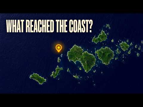
The first assessments of the earthquake off northern Vanuatu point to low humanitarian impact. They do not yet tell us whether people were hurt, homes were damaged or essential services were interrupted. For an estimated 4,000 people within the level-IV shaking area, that distinction separates a reassuring forecast from an account of what actually happened. 1 21
The reviewed magnitude-6.3 mb earthquake struck on October 24, 2026, at 1:35:57 p.m. Vanuatu time—02:35:57 UTC—170 kilometres northwest of Port-Olry. Its listed depth was 10 kilometres. The Global Disaster Alert and Coordination System, or GDACS, corroborates the magnitude, depth and time to the minute. 1 21
The other important uncertainty is coastal safety. The earthquake catalog carries a no-tsunami flag, while GDACS lists a six-centimetre value in two wave fields. Neither entry establishes current instructions for coastal communities, and event-specific guidance from Vanuatu’s national authorities has not been verified. 1 21 6
What the reassuring estimates actually mean
The US Geological Survey record assigns the earthquake a green PAGER alert. GDACS assesses its potential humanitarian impact as low and gives it a score of zero, based on the magnitude, population exposure and vulnerability. These are assessments of expected consequences, not a confirmed tally of casualties or damaged buildings. Zero on that assessment is not a report of zero losses. 1 21
Likewise, the estimate of about 4,000 people exposed to Modified Mercalli intensity IV does not mean 4,000 people were injured, displaced or needed assistance. It describes the estimated population within a shaking-intensity area. Reports from those communities are still needed to establish the consequences. 21
The earthquake’s magnitude and its shaking intensity answer different questions. The reviewed magnitude is 6.3 mb: the letters identify a body-wave magnitude, based on seismic waves travelling through the Earth. It should not be silently relabelled as a moment-magnitude measurement. The maximum estimated intensity in the event record is 4.458 on the Modified Mercalli scale, describing shaking at a location rather than the size of the earthquake itself. 1
Those distinctions matter because a detailed earthquake record can look more conclusive than it is. A precise origin time and an estimated shaking footprint can establish where and when a shock occurred without establishing whether a particular building, road or communications service survived undamaged.
A catalog flag is not guidance
The tsunami information needs the same care. GDACS lists 0.06 metres—six centimetres—in both its maximum-wave-alert and maximum-wave-realtime fields. No station, coastal location or observation record has been established for that value. Despite the field names, it cannot responsibly be described as a measured wave reaching a particular shore. 21
Nor does its presence necessarily contradict the USGS catalog’s no-tsunami flag. The flag’s precise operational meaning and the provenance of the GDACS wave values remain unresolved. Without those definitions, the two entries cannot be treated as competing answers to the question coastal residents need answered: what instructions apply now? 1 21
The Watchers, in its October 24 report on the wider earthquake sequence, says the Pacific Tsunami Warning Center stated at 03:28 UTC that the tsunami threat had passed. But the underlying bulletin and its application to this particular earthquake have not been verified. Neither has an event-specific instruction or cancellation from Vanuatu’s Meteorology and Geo-Hazards Department, known as VMGD, or the National Disaster Management Office. 11 6
VMGD’s earthquake listing is dated October 24, but that listing does not establish an advisory issue time or current coastal instructions. Separate reporting about safety after an October 20 earthquake concerns an earlier event; it cannot serve as an October 24 all-clear. 6 24 25
Several shocks, one unresolved sequence
The magnitude-6.3 event sits among four other separately identified nearby earthquakes. EarthquakeTracker’s listings attribute their solutions to USGS-reviewed records, but independent primary confirmation of those surrounding events was unavailable. Their distinct identifiers and origin times distinguish them from repeated reports or updates of the same earthquake. All four have listed depths of 10 kilometres. 5 9 8 7
Nearby earthquakes, in UTC
- October 23, 22:05:10 UTC5
EarthquakeTracker lists a magnitude-5.1 mww earthquake 203 kilometres northwest of Port-Olry.
- October 24, 00:27:44 UTC9
A separate listing places a magnitude-4.5 mb earthquake 195 kilometres northwest of Port-Olry.
- October 24, 02:35:57 UTC1
The reviewed magnitude-6.3 mb earthquake strikes 170 kilometres northwest of Port-Olry.
- October 24, 03:08:45 UTC8
EarthquakeTracker lists a magnitude-5.1 mb earthquake 170 kilometres northwest of Port-Olry.
- October 24, 03:17:55 UTC7
A magnitude-5.2 mb earthquake is listed 202 kilometres northwest of Port-Olry.
Their official relationship has not been established. Calling the earlier shocks foreshocks, or the later ones aftershocks, would go beyond the verified classification. A separate 06:36 UTC timestamp attached to the magnitude-6.3 listing is a record update, not another earthquake. 6 13
There is also an unresolved difference in accounts of the largest shock. The Watchers’ October 24 report describes a magnitude-6.9 earthquake at about 02:31 UTC, shortly before the 6.3. Faultline’s sequence tally instead identifies 6.3 as the largest event in its reporting period. Different reporting windows, distinct earthquakes or a magnitude revision could explain the apparent discrepancy, but the larger event’s identity and magnitude history have not been established. Neither account settles the other. 11 12
For now, the strongest conclusion is also a limited one: the magnitude-6.3 offshore earthquake has a low estimated humanitarian impact. That is meaningful reassurance, but it does not close the two practical questions still facing the affected islands—what happened in their communities, and what current coastal-safety instructions national authorities issued. 21 6
As aired 16 lines
- A magnitude-six-point-three earthquake struck offshore from northern Vanuatu.
- About four thousand people are estimated to have been within an area of level-four shaking. The unresolved questions are the damage on land and the current safety guidance for coastal communities.
- The earthquake struck one hundred seventy kilometres northwest of Port-Olry, at a listed depth of ten kilometres. It happened on October twenty-fourth, twenty twenty-six, at about one thirty-five in the afternoon, local time.
- The reviewed magnitude is six point three on the body-wave scale, which uses seismic waves travelling through the Earth. The measurement is labelled m b. That label belongs with the magnitude when comparing this earthquake with others.
- About four thousand people fall within the estimated level-four shaking area. That gives the earthquake a human scale beyond its offshore location. The estimate counts people exposed to shaking; their actual circumstances still depend on what happened in their communities.
- Shaking intensity describes conditions at a particular location. The maximum estimated intensity is four point four five eight on the Modified Mercalli scale. Magnitude describes the earthquake itself, while intensity helps describe how its shaking reaches different places.
- The initial humanitarian assessment is low, with a score of zero. The earthquake also carries a green alert for expected impacts. Those assessments consider the earthquake's magnitude, the population exposed and people's vulnerability. They estimate consequences before local conditions are fully known.
- We still don't know whether anyone was hurt, or whether buildings and essential services were damaged. The low-impact assessment offers some reassurance, but communities' experiences are the information needed to understand the actual consequences.
- Port-Olry is the reference point for locating the offshore shock. For coastal communities, the practical concerns extend beyond shaking to tsunami instructions. The earthquake catalog and the disaster assessment contain different kinds of tsunami information, and each needs careful interpretation.
- Four other nearby earthquakes surround the six-point-three in time. They're listed as separate events, each with its own origin time and identifier. All four have listed depths of ten kilometres. Their official relationship to the six-point-three hasn't been determined.
- A magnitude-five-point-one shock and a four-point-five came before the six-point-three. A five-point-one and a five-point-two followed it. These are nearby shocks. Calling them aftershocks or foreshocks would require an official assessment of how the earthquakes relate to one another.
- A later update time attached to the six-point-three describes a change to its earthquake listing. The earthquake's origin time stays the same. A separate uncertainty concerns a larger magnitude mentioned in descriptions of the wider sequence.
- A magnitude-six-point-nine earthquake reportedly struck shortly before the six-point-three. Another sequence tally puts six-point-three highest in its reporting period. Different time windows, distinct earthquakes or a magnitude revision could explain the difference, but the larger event's identity remains unresolved.
- The tsunami catalog flag reads no. The disaster assessment also lists six centimetres in both its maximum-wave-alert and maximum-wave-realtime fields. We don't know whether that value came from a model or an observation, or which coast it might describe.
- A tsunami-threat-passed bulletin has also been reported for the wider sequence. Its application to this earthquake hasn't been confirmed. The catalog flag and the six-centimetre entry can't settle what instructions currently apply to people along the coast.
- Current event-specific instructions from Vanuatu's Meteorology and Geo-Hazards Department or National Disaster Management Office remain unclear. Safety statements about an October twentieth earthquake concern that earlier event. For October twenty-fourth, the humanitarian outlook is low, while conditions in affected communities and current coastal guidance still need confirmation.
Sources
25 sources13 outlets
earthquaketracker.org5
The Watcherswatchers.news2
Faultlineduskengineering.services1
inquirer.net1
iris.edu1
PMN | Pacific Media Networkpmn.co.nz1
SeismoWatchseismowatch.com1
UA.NEWSua.news1
vmgd.gov.vu1
Source map
Follow the evidence behind this report. The map shows its connections; the links below open the sources cited in this article.
Source map loads as you read.
Revision log
- r1First published.