
آفات · Oak Creek accessجاری خبر · 3 میں سے رپورٹ 2
Two highways reopen, but Sedona evacuees still lack an all-clear
I-17 and SR 260 reopened after flooding, but safe local routes, shelter intake and permission to return to Sedona’s evacuated neighborhoods remain unconfirmed.
نقلِ متن · لوڈ ہو رہا ہے
انگریزی میں دستیاب
جاری خبردن 1
3 رپورٹس40 ذرائع ابلاغ67 ماخذ
پوری خبر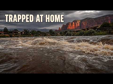


ہماری پچھلی رپورٹ کے بعد کیا بدلا
12 گھنٹے بعد
تب
Three Sedona zones ordered out as flooding traps people in homesجسے ہم نے حل طلب کہا تھا
The rescue total, safe road access, current shelter intake status and any subsequent change to the GO order remain unverified.
اب بھی حل طلبWatch for a dated official update addressing the evacuation order, rescue operations, road access and shelter arrangements before treating the emergency as resolved.
اب بھی حل طلب
اب
I-17 and SR 260 reopened after flooding, but safe local routes, shelter intake and permission to return to Sedona’s evacuated neighborhoods remain unconfirmed.
Two highway reopenings have eased Arizona’s flood-disrupted travel—but neither gives evacuated Sedona families an all-clear. Interstate 17 reopened in both directions Sunday afternoon, November 1, after hours-long closures. State Route 260 near Pinetop-Lakeside reopened around 4:30 p.m. Arizona time. Local street access, a safe route to shelter and permission to return home remain separate, unresolved questions. 7
In our November 1 broadcast, we reported immediate evacuations in Sedona’s east-side Zones 8, 9 and 10 as Oak Creek rose rapidly, along with reports of people trapped inside homes. The highway reopenings are the material change since that account. They restore important connections across the region; they do not establish that streets within the evacuation zones are passable or that the GO instruction has been lifted. The county alert corroborates the three-zone evacuation, but no verified lifting or replacement order is available. 8
What changed on the highways
The earlier I-17 restrictions stopped northbound traffic at State Route 179 and southbound traffic near Flagstaff Pulliam Airport, at milepost 337. AZFamily’s earlier November 1 closure account was superseded by afternoon reopening reports from FOX 10 Phoenix and other local outlets. AZFamily’s updated article also confirms that all lanes reopened in both directions. This is a change over time, not a disagreement about whether the interstate remains closed. 7 4
The available accounts support an afternoon reopening, not an exact official minute when traffic resumed. KNAU’s 2:19 p.m. MST update already described all lanes as reopened; ABC15 placed the transportation department’s announcement just before 3 p.m. Publication and announcement times should not be mistaken for a verified traffic-resumption time. 48 29
SR 260 had been closed by flooding near Pinetop-Lakeside at milepost 350. FOX 10’s earlier November 1 account still listed that restriction; AZFamily’s updated report says the highway reopened around 4:30 p.m. That later development supersedes the closed status. 4 7
Three other routes remained on AZFamily’s updated closure list, without estimated reopening times. Their present status has not been independently established through a timestamped transportation-authority incident record. They should be described as reported restrictions—not a verified list of roads still closed at this moment. 7
The restriction most directly tied to the Oak Creek corridor was SR 89A in both directions between Sedona and Kachina Village, mileposts 375–397. That is a 22-mile span toward the Flagstaff area, not every part of SR 89A. No verified reopening time or authorized evacuation detour is available for that segment. 7
The other listed restrictions were SR 73 between Indian Pine and Whiteriver, mileposts 351–357, and SR 238 between Maricopa and Gila Bend, for which the report supplied no milepost limits. These are separate highway segments elsewhere in Arizona, not interchangeable alternatives for getting through Sedona’s flooded neighborhoods or reaching its shelter. 7
Heavy rain also brought rockfalls. Transportation crews used plow trucks to clear debris from northern Arizona travel lanes. That is one reason a falling creek gauge cannot certify a road as safe: water recession does not show that debris has been removed, pavement inspected or a restriction lifted. Flooding also forced evacuations on White Mountain Apache tribal lands; Camp Verde separately ordered evacuations near the Verde River, West Clear Creek and Wet Beaver Creek. 7 1
A reopened interstate restores a connection. It does not establish a safe route home.
One creek, sharply different readings
The evening water measurements show why the emergency cannot be reduced to a single improving number. At Sedona, Oak Creek measured 12.88 feet at 7:45 p.m. MST Sunday, below its 14-foot flood stage. At Cornville, the 8 p.m. reading was 16.93 feet against an eight-foot flood stage—8.93 feet above that threshold. 2
The morning observations were very different: Sedona measured 15.06 feet at 7:45 a.m., while Cornville measured 8.88 feet at 8 a.m. Radar and automated gauges indicated 1.25 to 2.5 inches of rain across the warned area by 8:15 a.m. These newly supplied warning-carried observations add numerical evidence that our earlier report had not established. They are snapshots at two locations, not a verified continuous record or a final crest. 8
The highway changes are documented in updated local reporting rather than a directly retrieved ADOT incident log. The creek figures and forecasts come from the supplied National Weather Service and county alert material; the original alert pages were not independently accessible. Those limits matter most when assessing what is open now and whether the predicted recession has actually happened.
The evening Flood Warning, issued at 8:35 p.m. MST November 1, described flooding already occurring, roads closed and impassable in the warned area, and possible additional overnight rises from upstream rainfall. It forecast a Cornville crest late Sunday night and a fall below flood stage late Monday morning. It did not identify the affected roads, so it cannot independently establish the status of a particular state highway. 2
The warning was scheduled to expire at noon MST Monday, November 2. That is a weather-warning deadline, not a return-home authorization. The earlier morning Flash Flood Warning’s scheduled 11:15 a.m. Sunday expiration likewise did not establish an end to the evacuation. Neither forecast recession nor an elapsed warning period substitutes for an official change to the GO instruction. 2 8
What families still need confirmed
Sedona Fire District Chief Ed Mezulis said responders were handling multiple reports of residents trapped inside homes, with crews from surrounding communities coming to assist. Firefighters called in extra personnel. The available reports still do not establish how many people were trapped, how many rescues were completed, or totals for injuries, deaths, evacuated households or property damage. Missing totals are not evidence that no harm occurred. 5 4
Sedona Red Rock High School was the named evacuation destination. Current intake, hours, capacity and a verified safe route to the school remain unconfirmed, as do dependable street-level boundaries for the three zones. A highway reopening cannot fill those gaps. 8
The practical guidance remains direct: do not cross flooded roads, and stay away from washes and creek beds. People in immediate danger were directed to higher ground and told to call 911 when safe. For families deciding whether to leave, travel or return, the deciding evidence must be official direction for their location—not an open interstate, a lower reading elsewhere or a clock reaching noon. 6 8
جیسا نشر ہوا 18 سطریں
- Interstate 17 has reopened in both directions, restoring travel after hours of flood closures. But families evacuated near Oak Creek still face flooded local roads and uncertainty about returning home.
- On November 1, we reported immediate evacuations in Sedona's east-side Zones 8, 9 and 10 as Oak Creek rose rapidly. The highway reopenings now change the travel picture around those neighborhoods.
- Which roads have reopened, and what does that mean for families trying to leave or return? State Routes 89A, 73 and 238 were reportedly still closed Sunday evening. Their current status isn't clear, and no reopening estimates were available.
- State Route 89A's restriction covered both directions between Sedona and Kachina Village, from milepost 375 to 397. That's a 22-mile span through the Oak Creek corridor toward Flagstaff, affecting a highway connection out of the Sedona area.
- The earlier Interstate 17 closures blocked northbound traffic at State Route 179 and southbound traffic near Flagstaff Pulliam Airport, at milepost 337. Those restrictions lasted hours before all lanes reopened Sunday afternoon. That reopening restores the interstate connection, while access within the flooded neighborhoods remains a separate problem.
- Interstate 17 moved from closures in both directions to all lanes reopened during the afternoon. The earlier restrictions belong to the history of this emergency. They shouldn't be counted as closures still in effect after the reopening.
- State Route 260 also reopened after flooding near Pinetop-Lakeside, around milepost 350. Traffic resumed around 4:30 p.m. Arizona time on November 1, superseding its earlier closed status. That adds a second reopening to the day's transportation changes.
- The other reported restrictions covered State Route 73 between Indian Pine and Whiteriver, from milepost 351 to 357, and State Route 238 between Maricopa and Gila Bend. Those are separate highway segments elsewhere in Arizona. They don't provide an authorized evacuation route through Sedona.
- Transportation crews used plow trucks to clear rockfall debris from northern Arizona travel lanes. Heavy rain created hazards beyond rising water. A lower creek reading alone can't tell drivers whether workers have cleared and inspected a road.
- Flooding also forced evacuations on White Mountain Apache tribal lands. Camp Verde separately ordered evacuations near the Verde River, West Clear Creek and Wet Beaver Creek. In Sedona, local street closures compounded the highway restrictions as emergency crews responded along Oak Creek.
- Radar and automated gauges indicated 1.25 to 2.5 inches of rain across the warned area by Sunday morning. Oak Creek's measurements then changed very differently at two locations. The morning and evening readings show why one observation can't describe conditions along the whole creek.
- At Sedona, Oak Creek measured 15.06 feet in the morning and 12.88 that evening. Its flood stage is 14 feet. Cornville rose from 8.88 to 16.93 feet, against an eight-foot flood stage.
- Cornville's evening reading stood 8.93 feet above flood stage. The weather service warned of flooding and impassable roads in Coconino and Yavapai counties, with further rises possible from upstream rain. Those measurements describe the creek at specific times; they don't clear a highway or cancel an evacuation.
- The evening Flood Warning was issued at 8:35 p.m. Sunday and scheduled to expire at noon Monday, November 2. The forecast called for Cornville to crest late Sunday night and fall below flood stage late Monday morning. Further overnight rises were still possible.
- Sedona Fire District Chief Ed Mezulis said crews were responding to multiple reports of people trapped inside homes. Firefighters called in extra personnel, and surrounding communities sent assistance. Officials directed evacuees to Sedona Red Rock High School.
- There still isn't a confirmed total of completed rescues or casualties. Current shelter intake and a safe route to the school haven't been confirmed. The county alert supports the three-zone GO instruction, but officials haven't provided a confirmed lifting or replacement order here.
- The two highway reopenings partly resolve the access question. Families still need official direction on local routes and returning home. A forecast of falling water, or a warning reaching its scheduled expiration, doesn't give residents permission to return.
- The earlier morning Flash Flood Warning had been scheduled to expire at 11:15 a.m. Sunday. That deadline also didn't end the evacuation instruction. Officials warned drivers against crossing flooded roads and residents against approaching washes or creek beds. People in immediate danger were directed to higher ground and told to call 911 when safe.
ماخذ
49 ماخذ32 ذرائع ابلاغ1 ایجنسی کی خبر
ABC15 Arizona in Phoenix (KNXV)abc15.com2
ArcGIS StoryMapsarcgis.com2
KNAU Arizona Public Radioknau.org2سب سے پہلے
National Weather Serviceweather.gov2
The Verde Independentverdenews.com2
Arizona Daily Sunazdailysun.com1
Arizona Expressarizona-express.com1
az.gov1
az511.com1
azdot.gov1
Colorado Springs Gazettegazette.com1
- پہلی بار رپورٹ کیا
- More rain triggers flash flood evacuations in Colorado, Arizona
flagscanner.com1
floodriskhere.com1
FOX 10 Phoenixfox10phoenix.com1
- پہلی بار رپورٹ کیا
- Sedona flooding triggers evacuations and closes multiple Arizona highways
Jacksonville Journal-Couriermyjournalcourier.com1
KGUN 9 Tucson Newskgun9.com1
KVOAkvoa.com1
roadconditions.com1
Rolling Outrollingout.com1
- پہلی بار رپورٹ کیا
- Which Arizona highways are closed by flooding right now?
Sedona Red Rock Newsredrocknews.com1
- پہلی بار رپورٹ کیا
- Sedona urges evacuation of areas along Oak Creek
Storm Station 247stormstation247.com1
Telemundo Phoenix/Tucsontelemundoarizona.com1
- پہلی بار رپورٹ کیا
- Cierres por fuertes lluvias e inundaciones en Arizona
WHEC.comwhec.com1
ذرائع کا نقشہ
اس رپورٹ کے شواہد دیکھیں۔ نقشہ اس کے روابط دکھاتا ہے؛ نیچے دیے گئے روابط اس مضمون میں درج ماخذ کھولتے ہیں۔
آپ کے پڑھنے کے دوران ماخذ کا نقشہ لوڈ ہوتا ہے۔
ترامیم کا ریکارڈ
- r1پہلی بار شائع ہوا۔