Disasters · Tornado watch
Tornado Watch 681 narrows to four Virginia counties and Emporia
As of 6:12 p.m. EDT on October 11, four Virginia counties and Emporia remained in the land continuation. Limited river threats persisted, with an 8 p.m. scheduled expiration—not an all-clear.
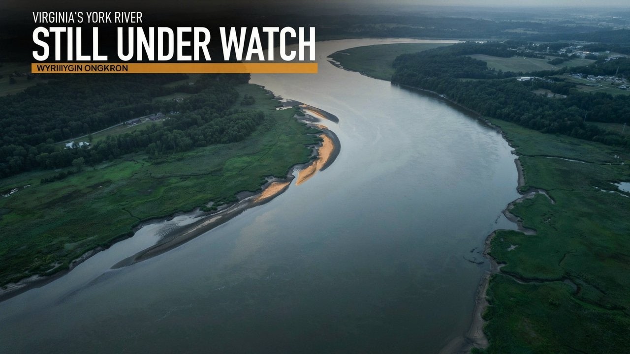
Transcript · LOADING
Story trackerDay 6
1 report90 outlets223 sources

What still needs watching when a tornado watch shrinks? For Tornado Watch 681, the early-evening answer was four Virginia counties, the independent city of Emporia and a much shorter list of waterways—not the broad coastal footprint named when the alert began.
As of 6:12 p.m. EDT on October 11, 2026, the watch was still scheduled to end at 8 p.m. No extension or complete cancellation had been established. Wakefield’s late-afternoon land continuation covered Brunswick, Dinwiddie, Greensville and Mecklenburg counties, plus Emporia. Tornadoes remained possible; the watch itself did not establish that one had occurred. 17 28
That is the useful distinction for anyone checking an afternoon alert against an evening plan: the original coverage tells you where the watch started, not necessarily where it remained. A smaller watch is still a preparation alert for people inside it, and its scheduled expiration is not a promise that every weather hazard will end at that hour.
Where the evening threat remained
The National Weather Service office in Wakefield issued a continuation at 4:51 p.m. EDT stating that Watch 681 “REMAINS VALID UNTIL 8 PM EDT THIS EVENING.” Its list called the remaining land areas “5 counties,” but the named jurisdictions were four counties and one independent city. Emporia belongs in the total, not in the county count. 17
Chase City, Clarksville, Lawrenceville and South Hill were among the communities named within that continuing area. Those names help residents locate themselves; they do not add separate county jurisdictions to the watch. 17
How Watch 681 narrowed
- October 11, 1:55 p.m. EDT1425
The Storm Prediction Center begins Watch 681 for parts of eastern North Carolina, southeastern Virginia and coastal waters.
- October 11, 1:56 p.m. EDT12
Wakefield issues its local land and marine notices, with an 8 p.m. EDT scheduled expiration.
- October 11, 4:51 p.m. EDT17
Wakefield’s land continuation lists Brunswick, Dinwiddie, Greensville and Mecklenburg counties and Emporia.
- October 11, 5:50 p.m. EDT58
SPC Status Report 2 lists the same Virginia jurisdictions and limited river zones, with no North Carolina land county in its threat guidance.
The Storm Prediction Center’s second status report, valid from 5:50 to 6:40 p.m. EDT, identified continuing marine threat areas as the Pamlico and Pungo Rivers, the Neuse and Bay Rivers, and the York River. Their zone codes were AMZ136, AMZ137 and ANZ636. A separate marine continuation retained residual North Carolina waters. 58 17
An earlier status report, valid from 5:45 to 6:40 p.m., had still listed Onslow County, North Carolina, alongside the five Virginia jurisdictions and a longer marine list, including coastal segments between Oregon Inlet and Cape Lookout. The next report supplied a narrower picture. 58
There is a limit to what that change establishes. SPC explicitly labels its status messages as guidance and directs readers to local Watch County Notifications for official information on counties, independent cities and marine zones cleared from a watch. A county’s omission from the guidance alone is not its official cancellation notice. The Virginia land continuation is specific; people elsewhere should check the current local alert rather than treat the status report as a substitute. 58
Why the original lists looked different
Watch 681 began at 1:55 p.m. EDT at the Storm Prediction Center; Wakefield’s local notices followed one minute later. Those adjacent timestamps describe the same watch, not two competing alerts. Both carried the same scheduled end: 8 p.m. EDT on October 11, equivalent to midnight UTC on October 12. 14 1 2
The initial Virginia wording also needed a counting correction. Its “26 counties” were actually 26 jurisdictions: 12 counties and 14 independent cities. The counties were Brunswick, Charles City, Dinwiddie, Greensville, Isle of Wight, James City, Mecklenburg, Prince George, Southampton, Surry, Sussex and York. 2 25
The independent cities were Chesapeake, Colonial Heights, Emporia, Franklin, Hampton, Hopewell, Newport News, Norfolk, Petersburg, Poquoson, Portsmouth, Suffolk, Virginia Beach and Williamsburg. They were included in the 26—not another 14 places to add on top. That original list is historical coverage for the afternoon issuance, not the evening land continuation. 25
North Carolina’s two initial totals likewise described different geographic scopes. Wakefield’s portion included nine counties: Bertie, Camden, Chowan, Currituck, Gates, Hertford, Northampton, Pasquotank and Perquimans. The full SPC outline included those nine plus Beaufort, Carteret, Craven, Dare, Hyde, Jones, Martin, Onslow, Pamlico, Tyrrell and Washington, for 20 North Carolina counties altogether. Nine versus 20 was an office-coverage distinction, not a disagreement over the same list. 2 25
The original marine notice was equally precise. It covered Chesapeake Bay from New Point Comfort to Little Creek and from Little Creek to Cape Henry, including the Chesapeake Bay Bridge-Tunnel; Currituck Sound; and the York River. James River coverage ran from Jamestown to the James River Bridge, then from that bridge to the Hampton Roads Bridge-Tunnel, including the Elizabeth River. Offshore coverage extended from Cape Charles Light to the Virginia–North Carolina border and onward to Currituck Beach Light, out 20 nautical miles in each segment. 1
Those were boundaries, not observations. Naming a river or bay did not mean a tornado or waterspout had been seen there. And “out 20 nautical miles” defined the coastal watch area; it was not a recommended distance to keep from a storm.
Prepare now, act on a warning
A watch means conditions favor the hazard and people should prepare for warnings. A warning means the event is imminent or occurring nearby and calls for protective action. Wakefield’s official criteria put that instruction plainly: “Take action to protect life and property.” 11
For people in covered areas, NWS guidance is to review and discuss emergency plans, inventory supplies, check safe-room arrangements and be ready to act quickly if a warning is issued or a tornado appears to be approaching. Monitoring is an active task, not a reason to postpone preparation until a warning arrives. People using waterways also need to follow alerts for their particular marine zone, rather than rely solely on a county name. 134 1
The initial alert’s metadata used three different classifications: tornado certainty was “Possible,” severity was “Extreme,” and the recommended response was “Monitor.” They answer different questions. “Extreme” does not convert a possible tornado into a confirmed one, and it does not measure an observed tornado’s strength. 2
No official confirmed tornado was identified within Watch 681’s own area and valid period in the material examined through 6:12 p.m. EDT. That is not proof none occurred. Warnings, preliminary observations and completed confirmation are different stages of evidence, and the watch was still within its scheduled period. 33 61
The remaining checks are therefore separate: whether the watch actually ended on schedule or changed again, and whether later observations or surveys establish tornadoes or damage inside its footprint. For the early-evening reader, the immediate instruction was simpler: check the updated geography, prepare if still covered, and do not mistake either a smaller watch or an approaching expiration for an all-clear.
As aired 22 lines
- Forecasters narrowed Virginia's tornado watch from 26 land jurisdictions to five.
- Tornadoes remain possible for people in the remaining land areas and along several rivers. The watch is scheduled to end at eight tonight, but that deadline doesn't promise an end to every weather hazard.
- Which land areas and waterways still face the threat as the watch approaches its scheduled end?
- Brunswick, Dinwiddie, Greensville and Mecklenburg counties remain covered, along with the independent city of Emporia. Forecasters kept those five jurisdictions under Tornado Watch 681 in the late-afternoon continuation. The much larger original footprint had already narrowed.
- Emporia counts as an independent city. The continuation called its list five counties, but it named four counties and Emporia. Virginia's independent cities are separate jurisdictions, so that shorthand can make the county count sound larger than it is.
- Chase City, Clarksville, Lawrenceville and South Hill are among the communities named within that continuing land area. Those community names help residents locate themselves within the watch. They don't add more counties to its coverage.
- The original Virginia notice covered 26 jurisdictions. The later continuation kept five land areas covered, with the scheduled end still eight tonight. That reduction changes who needs to prepare, even while the remaining communities continue facing a possible tornado threat.
- The Storm Prediction Center began Watch 681 at 1:55 in the afternoon on October 11. Wakefield issued its local land and marine notices one minute later. Both set the same evening expiration.
- The initial notice also called Virginia's coverage 26 counties. Its complete list contained 12 counties and 14 independent cities, making 26 jurisdictions altogether. That earlier footprint stretched across south-central and southeastern Virginia, including Hampton Roads cities that aren't in the later five-area land continuation.
- Wakefield's initial North Carolina notice covered nine counties. The full interstate watch covered 20 North Carolina counties, including those nine. Different weather offices handled different portions of the same watch, so the larger total describes a wider geographic area.
- The Chesapeake Bay Bridge-Tunnel was inside the original marine footprint. That coverage ran from New Point Comfort to Little Creek, then from Little Creek to Cape Henry. These were specific stretches of the bay where people needed to prepare for possible tornadoes.
- Currituck Sound and the York River were also included. The James River coverage ran from Jamestown to the James River Bridge, then onward to the Hampton Roads Bridge-Tunnel. That second stretch included the Elizabeth River.
- The original coastal coverage extended 20 nautical miles offshore. It ran from Cape Charles Light to the Virginia–North Carolina border, and from there to Currituck Beach Light. The broader watch also included the Alligator River, Pamlico Sound, and Albemarle, Croatan and Roanoke sounds.
- For people using those waters, the alert geography follows named water zones as well as land boundaries. The offshore distance defines the covered area. Boaters still need to follow the changing alerts for their particular waterway.
- Onslow County remained in the earlier evening threat guidance, alongside the five Virginia jurisdictions and a longer marine list. The next guidance omitted North Carolina land counties and reduced the marine list. Both guidance periods ran through 6:40 in the evening.
- The remaining river threat guidance named the Pamlico and Pungo Rivers, the Neuse and Bay Rivers, and the York River. A separate marine continuation retained residual North Carolina waters. The evening concern had become much more geographically limited.
- Local watch notifications control official clearances. The broader threat guidance helps describe where the danger continues, but dropping a county from that guidance alone doesn't serve as its official cancellation notice. Residents need the current local alert for their location.
- The watch classifies tornadoes as possible and tells people to monitor conditions. Its severity field says extreme. That describes the alert's hazard category. It doesn't measure the strength of an observed tornado or mean a tornado has touched down.
- A warning calls for protective action because the event is imminent or occurring nearby. Under a watch, conditions favor the hazard and people should prepare for warnings. That preparation gives households time to get ready before they need to act quickly.
- People in covered areas should review and discuss emergency plans, check supplies and safe-room arrangements, and follow changing weather alerts. Be ready to act quickly if a warning arrives or a tornado appears to be approaching.
- Officials hadn't confirmed a tornado within this watch's area and active period by early evening. Warnings and preliminary observations can come before later confirmation. Later observations or surveys could still identify a tornado or damage within this footprint.
- As of 6:12 p.m. Eastern, the watch hadn't been extended or completely canceled. The four Virginia counties and Emporia remained in the land continuation, with limited river areas in the threat guidance. Its scheduled eight o'clock expiration would end the watch period, without certifying that every weather hazard had ended.
Sources
223 sources90 outlets
National Weather Serviceweather.gov38
- First reported
- Tornado Watch issued October 11 at 1:56PM EDT until October 11 at 8:00PM EDT by NWS Wakefield VA
- Tornado Watch issued October 11 at 1:56PM EDT until October 11 at 8:00PM EDT by NWS Wakefield VA
- Wakefield, VA
- National Weather Service
- WARNING/ADVISORY CRITERIA
- Frequently Asked Questions (FAQ)
- WWA Summary for All Issued by RAH
- www.weather.gov
- WWA Summary for Tornado Watch
- National Weather Service
- WWA Summary by Location for 36.97N 76.3W with ANZ638/ANC638/ANZ638 emphasis Heavy Freezing Spray Warning
- WWA Summary for Tornado Watch Issued by LWX
- WWA Summary for Tornado Watch Issued by RAH
- National Weather Service
- National Weather Service
- National Weather Service
- National Weather Service
- WWA Summary by Location for 37.04N 76.15W with ANZ632/ANC632/ANZ632 emphasis Tornado Watch
- WWA Summary for All Issued by AKQ
- National Weather Service
- WWA Summary for All Issued by RAH
- National Weather Service
- WWA Summary for Tornado Watch Issued by CHS
- National Weather Service
- National Weather Service
- National Weather Service
- National Weather Service
- www.weather.gov
- Decision Support Weather Briefing
- Convective Watch Job Sheets
- Understand Tornado Alerts
- NWS Products and Criteria
- Watch/Warning/Advisory Definitions
- WARNING/ADVISORY CRITERIA
- Severe Weather Preparedness
- WWA Summary for All Issued by MHX
- National Weather Service
- Watches, Warnings & Advisories
GOES Image Viewer - NOAA/NESDIS/STAR websitenoaa.gov36
- First reported
- tgftp.nws.noaa.gov
- Storm Prediction Center Tornado Watch 681
- tgftp.nws.noaa.gov
- Initial List of Counties in SPC Tornado Watch 681 (WOU)
- Storm Prediction Center - Current Convective Watches
- Storm Prediction Center Oct 11, 2026 2000 UTC Day 1 Convective Outlook
- www.spc.noaa.gov
- Storm Prediction Center Tornado Watch 681 Status Reports
- Storm Prediction Center Severe Thunderstorm Watch 681 Status Reports
- Storm Prediction Center Tornado Watch 681
- Storm Prediction Center Severe Thunderstorm Watch 681 Status Reports
- Storm Prediction Center Severe Thunderstorm Watch 681 Status Reports
- Storm Prediction Center Severe Thunderstorm Watch 681
- Storm Prediction Center Tornado Watch 681 Status Reports
- Storm Prediction Center Severe Thunderstorm Watch 681 Status Reports
- Storm Prediction Center Tornado Watch 681 Status Reports
- Storm Prediction Center Tornado Watch 681 Status Reports
- tgftp.nws.noaa.gov
- READY -
- tgftp.nws.noaa.gov
- Storm Prediction Center Severe Thunderstorm Watch 681 Status Reports
- Storm Prediction Center Severe Thunderstorm Watch 681 Status Reports
- Initial List of Counties in SPC Severe Thunderstorm Watch 681 (WOU)
- Initial List of Counties in SPC Tornado Watch 680 (WOU)
- Storm Prediction Center Severe Thunderstorm Watch 81 Status Reports
- Storm Prediction Center Severe Thunderstorm Watch 106 Status Reports
- Storm Prediction Center Mesoscale Discussion 881
- Atlantic Tropical Weather Discussion
- Post-Tropical Cyclone Isaias Public Advisory
- NOAA STAR Integrated Calibration/Validation System (ICVS) - Instrument Status - NPP OMPS NM
- All media advisories | National Oceanic and Atmospheric Administration
- WPC 6-Hour Probability of Precipitation Guidance for Days 1-3
- Day 3-7 U.S. Hazards Outlook
- www.ndbc.noaa.gov
- WPC Medium Range Archive
- West Coast Regional Office | NOAA Fisheries
Iowa Environmental Mesonetiastate.edu17
- mesonet.agron.iastate.edu
- IEM :: SPC Watches Listing
- IEM :: WCN from NWS MPX
- NWS Watches Warnings Advisories Download - IEM
- IEM :: WCN from NWS OTX
- IEM :: TAF from NWS AKQ
- mesonet.agron.iastate.edu
- IEM :: OK_DCP Network Summary for 11 Oct 2026
- IEM :: CA_QC_ASOS Network Summary for 11 Oct 2026
- www.mesonet.agron.iastate.edu
- IEM :: SYN from NWS BOU
- mesonet.agron.iastate.edu
- IEM :: CLI from NWS LOT
- www.mesonet.agron.iastate.edu
- www.mesonet.agron.iastate.edu
- IEM :: ZFP from NWS GLD
- VTEC Event 2026-O-NEW-KLWX-SC-Y-0006
X (formerly Twitter)x.com12
- First reported
- 12:58pm CDT #SPC_Watch WW 681 TORNADO NC VA CW 111755Z - 120000Z, #ncwx #vawx #cwwx, https://www.spc.noaa.gov/products/watch/ww0681.html
- Tornado Warning including Quarryville PA, Delta PA and Wakefield PA until 9:45 PM EDT https://twitter.com/NWStornado/status/2066323195360117002/photo/1
- A tornado watch has been issued for parts of North Carolina, South Carolina and Virginia until 6 PM EDT
- #SPC issues Day 1 Slight Convective Risk at Oct 11, 16:29z for LWX https://www.spc.noaa.gov/products/outlook/archive/2026/day1otlk_20261011_1630.html
- 44
- RT @Notasaint99: That one message is community note alert
- 96
- Wake County school board work session to discuss policy changes requiring principals to allow all education employee associations like NCAE onto schools & review student due process appeal process. Agenda at https://simbli.eboardsolutions.com/SB_Meetings/ViewMeeting.aspx?S=920&MID=19146 Watch at https://www.youtube.com/watch?v=3uly83Unj1Q #wcpss
- 🟇 #NATO Multinational Multi-Role Tanker Transport Fleet (9); 2026-10-06Z ➢ 7 (78%) of the fleet has flown in the past 28 days. Eindhoven Air Base (EHEH) 🇳🇱 (2) ➢ T-055 #480C41 (18d) ➢ T-061 #480C47 Cologne Bonn Airport (EDDK) 🇩🇪 (3) ➢ T-058 #480C44 (13d) ➢ T-060 #480C46 (13d) ➢ T-056 #480C42 (2d) Orland (ENOL) 🇳🇴 (2) ➢ T-059 #480C45 ➢ T-062 #480C48
- Although it's hard to know what's real in a disinformation-rich environment like Ethiopia, it's definitely true that lots of money is spent on weapons by people who frankly have better things to do with it.
- AKQ issues Coastal Flood Statement valid at Oct 11, 7:00 AM EDT for Accomack, Northampton [VA] till Oct 11, 3:00 PM EDT https://mesonet.agron.iastate.edu/vtec/f/2026-O-NEW-KAKQ-CF-S-0015_2026-10-11T11:00Z
- Direct link to the data. https://ndawn.info/currentwx/watkins A reminder that those current pages will have a major update coming soon, hopefully sometime in November.
FlightAwareflightaware.com4
grail-watch.com3
- First reported
- Zenith 681
- grail-watch.com
- Seiko 6810
capeweather.com2
【公式】スカパー!スポーツ、音楽、アニメ、 映画をTVでもスマホでも視聴可skyperfectv.co.jp1
aboutnumber.ru1
af.mil1
Alaska Airlinesalaskaair.com1
Apple Podcastsapple.com1
armywarcollege.edu1
BQ Watchesbqwatches.com1
Business Quantbusinessquant.com1
calaverasenterprise.com1
- First reported
- LETTER TO THE EDITOR - Calaveras Enterprise
celestrak.org1
ChartExchangechartexchange.com1
chicagoweatherstation.com1
Chronoscoutchronoscout.co1
CommandEleven Intelligencecommandeleven.com1
Diyanet İşleri Başkanlığıdiyanet.gov.tr1
fairfaxcounty.gov1
Flight Statusflight-status.com1
fxempire.com1
GOV.WALESgov.wales1
hollandwatchgroup.com1
HowLongAgoGohowlongagogo.com1
https://www.wect.comwect.com1
https://www.witn.comwitn.com1
- First reported
- Tornado watch has been canceled
https://www.wmbfnews.comwmbfnews.com1
javsubtitled.com1
KeepTrackkeeptrack.space1
learnmeabitcoin.com1
ligaram.me1
LiveAuctioneersliveauctioneers.com1
MarketBeatmarketbeat.com1
MarketScreenermarketscreener.com1
militaryfactory.com1
minorplanetcenter.net1
nextearningsdate.com1
petersburgva.gov1
PlaneMapperplanemapper.com1
Prayer Timespray-times.com1
rozklad-pkp.pl1
s3.us-west-1.amazonaws.com1Unverified host
sotwesotwe.com1
- First reported
- NWS Storm Prediction Center @nwsspc - Twitter Profile
stockwatch.com1
The Area Codescodigosinternacionales.com1
- First reported
- +681 Country Code WhatsApp • The Area Code
The Watch Sitethewatchsite.com1First
- First reported
- The Seiko caliber 6810: the thin within
trac.jobs1
Traveling Lifestyletravelinglifestyle.net1
TU Newstradersunion.com1
TV Passporttvpassport.com1
Tygart Mediatygartmedia.com1
- First reported
- Storm Updates: NC Tornado Watch Live Oct 11
umd.edu1
upstatetoday.com1
USA 681 🛰 - Satellite information • ISS Trackerisstracker.pl1
Weichertweichert.com1
whatcomcounty.us1
wikipedia.org1
- First reported
- 2026 Wakefield Council election - Wikipedia
worldcubeassociation.org1
WSAV-TVwsav.com1

Source map
Follow the evidence behind this report. The map shows its connections; the links below open the sources cited in this article.
Source map loads as you read.
Revision log
- r1First published.