災害 · レイチェルの残存勢力継続報道 · 全2件中1件目のレポート
レイチェルの残存勢力でロングビーチの住宅が倒壊、内陸部でも洪水救助が相次ぐ
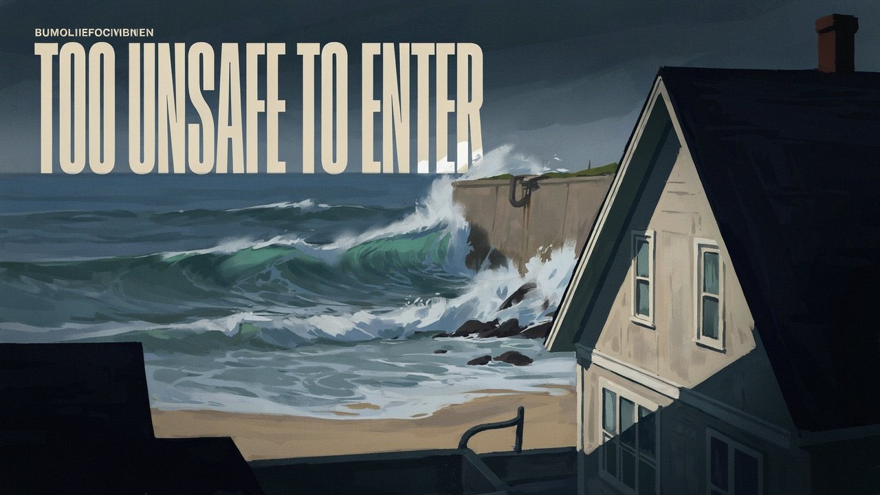
海岸沿いの護岸が崩壊し、ロングビーチでは住宅が倒壊して住民が避難を余儀なくされた一方、内陸部では洪水で人々が閉じ込められた。レイチェルが温帯低気圧になっても、安全が保証されるわけではない。
原語の動画
文字起こし · 読み込み中
英語の原文から翻訳されています。
継続報道3日目
2 件のレポート44 社のメディア78 件の情報源1 本の動画
ニュースの全体
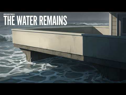
10月11日、ロングビーチのイースト・シーサイド・ウォーク沿いで、波が破損した護岸を越えて流れ込み続けるなか、海辺の住宅が倒壊した。海岸線を守るはずの壁は崩れ、水は流れ込み続けた。同日付の写真はその被害を示しており、64丁目と65丁目の間では遊歩道のさらなる崩落も報告された。2 7
レイチェルの残存勢力は、沿岸の洪水の脅威を、雨がやんだ後も続く避難生活と修復問題へと変えた。ロングビーチ当局は、海辺の住宅13戸が危険すぎて立ち入れないと報告した。内陸では、ABCニュースが、サンバーナーディーノの冠水した雨水排水路から2人が救助されたことと、ラスベガスで車両が冠水し救助活動が行われたことを報じた。嵐が温帯低気圧に変わったからといって、どちらの危険もなくなったわけではない。9 1
主な事実
10月11日に示した見通しは、南カリフォルニアで高波と洪水が発生する可能性に関するものだった。その後の報道は、被害や救助が起きる可能性だけでなく、実際に起きたことを記録している。ただし、これは最終的な集計ではない。死者・負傷者の集計を照合したもの、救助件数の包括的な集計、被害住宅の完全な一覧は確認されていない。死傷者数が示されていないことは、誰も負傷しなかった証拠ではない。
潮位は下がっても、住宅は危険なまま
ロングビーチの半島地区では、強制避難区域にシーサイド・ウォークの6400番地と6500番地のブロックが含まれていた。10月11日朝の報道によると、波が護岸を越えた後も、2ブロックの住宅には避難命令が出たままだった。住民の帰宅を認めるその後の通知は確認されていない。赤札は、該当する住宅が単に水で不便な状態というのではなく、立ち入るには危険すぎると判断されたことを意味する。9 3
被害は日曜日より前に始まっていた。ABC7は、海に崩れ落ちる危険がある住宅1戸を含む、危険判定の赤札が付いた住宅についてすでに報じていた。その記事には10月10日の日付が記されていたが、掲載メタデータは10月9日となっていた。この食い違いにより、最初の被害と避難の時刻は確定していない。明らかなのは、日曜日の被害が継続中の緊急事態の一部だったということだ。10
The Golden Coast Journalは、日曜日朝の潮位が予報より低く、土曜日を下回ったと報じた。それでも護岸の崩壊後、波は住宅を浸水させ、損壊し続けた。潮位が低くなっても、壊れた海岸防護施設を元に戻したり、危険な住宅を安定させたり、崩落した遊歩道を復旧したりすることはできなかった。3 7
赤札の枚数を数える際にも、単位を混同してはならない。KTLAはロングビーチ当局の発表として、危険な海辺の住宅が13戸あると報じた。一方、The Southbound 105は見出しで8棟としていた。後者の記事の時期と数え方の基準は不明だ。建物と住宅は必ずしも同じ単位ではなく、この数字を根拠に危険な住宅がさらに5戸増えたと責任をもって結論づけることはできない。どちらの報道も、市の住宅検査の全件一覧を示していない。9 39
ニューポートビーチでも、海岸沿いが閉鎖された。市は10月9日金曜日、バルボア半島の浸水を受けて地域の緊急事態を宣言し、住民に自宅と財産を守るよう呼びかけた。ABCニュースは10月11日までに、ニューポートビーチのすべてのビーチと桟橋が閉鎖されたと報じた。閉鎖が正確にいつ始まったのか、中断なくどのくらい続いたのか、いつ再開したのかは確認されていない。40 35 5
ABCの10月12日の報道は、ニューポートビーチで高さ少なくとも10フィートの防護壁が設置されていることも伝えた。この高さは独自に確認されておらず、正確な設置場所や建設資材も不明だ。10フィートというのは報じられた防護壁の高さであり、実測された波や高潮、建物の高さではない。高波と沿岸部の浸水は確認されているが、沿岸の水位を正確な数値で示す情報はない。1
内陸では、水が脱出路をふさぐ
ABCニュースによると、サンバーナーディーノでは洪水により2人が雨水排水路の中に閉じ込められ、2人とも救出された。記事は10月12日付だが、掲載日から救助がいつ行われたかは分からない。一次資料によって、正確な排水路の場所、出動機関、発生時刻、救助された人々の状態が確認されたわけではない。ABCはまた、ラスベガスで深刻な洪水により車が立ち往生し、救助活動が行われたと報じたが、市全体の救助件数は確認されていない。1
より正確な場所が特定された救助は、10月11日の日曜日、午前8時50分ごろ、ウィンチェスターのドメニゴニ・パークウェイとレオン・ロード付近で行われた。MyNewsLAによると、冠水した道路で立ち往生した車両の乗員1人を、リバーサイド郡消防の隊員が水位の上昇に伴い高台まで誘導した。報道は乗員を男性とは特定しておらず、車両が流されたとも述べていない。27
MyNewsLAはその日曜日、リバーサイド郡でウィンチェスターの乗員を含む運転者2人が救助されたと報じたが、確認できる詳細はその事案についてのみだ。これとは別に、ABCは車が流された後、洪水の中から男性が救助されたと報じ、場所を「Paris」と表記した。その場所は未確認のままだ。カリフォルニア州ペリス(Perris)は調査すべき綴りの候補ではあるが、確定した訂正ではない。フランスのパリで救助があったとする根拠はない。これらの報道は同じ事案を指している可能性があり、合算してより大きな件数を出すことはできない。27 1
降雨量の報告は内陸部で相当量の雨が降ったことを示しているが、観測期間の情報は不完全だ。The Californianは、土曜日から日曜日未明にかけて雨が降るなか、サンディエゴ郡の山間部で3インチを超える降雨量を報じた。The Golden Coast Journalは、パロマー山で最大5.16インチと報じた。どちらも、数値を確認済みの日降雨量または嵐全体の降雨量と呼ぶために必要な観測地点と全観測期間を示していない。パロマー山はより広い山間地域に含まれるため、数値は重複しており、合算できない。日曜日未明にはサンディエゴ郡で複数の水難救助も報告されたが、正確な件数は示されていない。6 8 19
予報は警戒解除を意味しない
米国立気象局サンディエゴ事務所が10月11日午前3時18分(太平洋夏時間)に発表した地域向け情報は、レイチェルの残存勢力がバハ・カリフォルニアと米国南西部の一部に大雨と突風をもたらし続けていると伝えた。同局独自の見出しの下には有効な監視情報や警報はなく、すべて解除されたと記載していた。この解除によって、別途発表された洪水や沿岸災害に関するすべての情報が取り消されたわけではない。21
その後、ラスベガス事務所が10月11日午後4時10分(太平洋夏時間)に発表した予報解説は、ネバダ州クラーク郡とリンカーン郡、アリゾナ州モハーベ郡について、日曜日の夜まで鉄砲水の危険が高い状態が続くとしていた。10月12日月曜日まで散発的なにわか雨があり、南寄りの強風は次第に弱まると予報した。これは日付のある予報期間を示すもので、洪水がさらに発生した証拠でも、ネバダ州やアリゾナ州の全域に現在警報が出ていることを示すものでもない。20
ABCは、レイチェルの残存勢力が接近中の別の気象システムと相互作用し、ユタ州、アリゾナ州、ネバダ州の一部に向けて北上していると説明した。第2の気象システムの正体や正確な相互作用は確認されておらず、有効期間が明確なユタ州向けの警報も確認されていない。提供された10月12日付の速報には、夜間と月曜日の予報がその後どのように変化したかを示すものはない。1
不明な点
- 最終的な死傷者数と被害総額、夜間および月曜日の追加被害、現在の避難・閉鎖状況は未確定のままだ。
今後の展開
- 住民が帰宅できる時期や海岸沿いへの立ち入りが再開される時期を確認するには、嵐の分類変更だけでなく、検査や再開に関する通知を確認してください。
この記事の情報源と報道
ABCニュース:「大雨と鉄砲水に備える数百万人」1 Los Angeles Times:ロングビーチの被災住宅と遊歩道。2 The Golden Coast Journal:半島地区の避難と日曜日の潮位。3 Wave Briefing:沿岸部の被害と救助。4 ABCニュース:ニューポートビーチの閉鎖。5
The Californian:南カリフォルニアの降雨と洪水。6 Long Beach Post:半島地区の被害と修復。7 The Golden Coast Journal:降雨、閉鎖、沿岸警報。8 KTLA:危険と判定されたロングビーチの住宅。9 ABC7:危険判定の赤札が付けられた半島地区の住宅。10 LAist:住宅を守ろうとする住民の取り組み。11
米国立気象局ラスベガス事務所の気象説明。12 ABCニュース:米国南西部の温帯低気圧レイチェル。13 Rolling Out:ニューポートビーチの洪水と内陸部の警報。14 The Weather Channel:地域の危険。15 KESQ:冠水した道路。16 Fox Weather:西部の洪水、雨、風。17 GPB:レイチェルの勢力低下。18 ArcaMax:サンディエゴ郡の雨と救助。19
米国立気象局ラスベガス事務所の予報解説。20 米国立気象局サンディエゴ事務所の地域向け情報。21 米国立気象局のハリケーン地域情報ページ。22 米国立ハリケーンセンターの温帯低気圧レイチェル予報解説。23 NBC 7 San Diego:熱帯低気圧監視解除後の危険。24 Las Vegas Sun:2つの嵐がもたらす地域の危険。25 米国立気象局ロサンゼルス/オックスナード事務所のページ。26
放送時の内容 19行
- Waves collapsed beachfront homes in Long Beach. Residents have been forced out of unsafe homes, while inland flooding has trapped people in vehicles and a storm drain. Rachel’s remnants are leaving damage along the coast and disrupting roads across parts of the Southwest. How long will the danger last for evacuated residents and people facing flooded roads?
- Waves kept flooding and damaging Peninsula homes on October 11 after a bulkhead failed. A bulkhead is a protective wall along the waterfront. Along East Seaside Walk, homes collapsed, and the boardwalk suffered further collapse between 64th and 65th Place.
- Rachel is now post-tropical, meaning it has lost its tropical storm structure. Its remnants still carry heavy rain and gusty winds. They’re interacting with another incoming weather system, bringing two different hazards. Coastal waves and high water batter waterfront protection, while inland rain overwhelms roads and drainage channels.
- Long Beach officials counted 13 beachfront residences red-tagged as too dangerous to enter. Residents can’t safely return to those homes. The failed coastal protection and damaged boardwalk also leave a repair problem that extends beyond clearing water from the streets.
- The evacuation area included the 6400 and 6500 blocks of Seaside Walk. Homes on those two blocks remained under mandatory evacuation orders on the morning of October 11, after waves overtopped the bulkhead. There’s no confirmed announcement allowing those residents back.
- Another red-tag tally gives eight buildings. That uses a different unit from the 13 residences, and the timing is unclear. The two figures can’t tell us whether five more homes became unsafe. A final count of damaged or destroyed homes isn’t available.
- Homes were already being red-tagged before October 11, including one at risk of falling into the ocean. Sunday morning’s tide was lower than forecast and below Saturday’s. But waves continued damaging homes after the bulkhead failed, leaving residents displaced even as the tide eased.
- Newport Beach closed all its beaches and piers amid unusually high ocean water. The city declared a local emergency on October 9 after flooding on the Balboa Peninsula, and urged residents to protect their homes and property. The waterfront closures were in place by October 11.
- Protective barriers at least 10 feet tall were reportedly being erected in Newport Beach. That height hasn’t been confirmed. It describes the barriers themselves. Heavy surf and coastal flooding damaged the waterfront, but there’s no confirmed numerical measurement of the waves or surge.
- Inland flooding also put people in immediate danger. In San Bernardino, two people became trapped inside a storm drain as water flooded it. Rescuers brought both out. In Las Vegas, severe flooding stalled vehicles and prompted rescues.
- Water interrupted movement across streets and drainage routes, and people needed help getting out. There’s no complete regional rescue count or settled death and injury total. Several water rescues were also reported in San Diego County before dawn on October 11.
- Riverside County Fire rescuers escorted one vehicle occupant to higher ground in Winchester on October 11. The vehicle was trapped on a flooded road near Domenigoni Parkway and Leon Road. Water was rising around it when rescuers helped the occupant out that morning.
- Two motorists were reportedly rescued in Riverside County that Sunday, including the Winchester occupant. Separately, a man was reportedly pulled from floodwater after his car was swept away, but his rescue location is unclear. Those incidents may overlap, so they can’t be added into a larger rescue total.
- San Diego County’s mountains reportedly received more than three inches of rain, with up to 5.16 inches on Palomar Mountain. The measurement periods aren’t specified. Palomar lies within the broader mountain area, so those figures overlap and can’t be added together.
- Rain fell across those mountain areas Saturday into early Sunday. Farther inland, the heaviest rain Sunday morning fell in parts of the southern Great Basin and Arizona’s Mohave County. The weather danger continued even after Rachel’s tropical watches and warnings were canceled.
- Rachel’s local tropical alerts had ended by early Sunday, but heavy rain and gusty winds continued across parts of Baja California and the southwestern United States. Separate flood and coastal alerts have their own schedules. Canceling the tropical alerts didn’t end those hazards.
- Flash-flood risk stayed elevated in the Sunday afternoon forecast for Clark and Lincoln counties in Nevada, and Mohave County in Arizona. That outlook covered Sunday night. Scattered showers were forecast to continue through Monday, October 12, with gusty south winds gradually tapering.
- The same forecast called for below-normal temperatures, including freezing conditions in parts of the southwestern Great Basin early in the workweek. Sunday’s outlook also included isolated thunderstorms and moderate-to-heavy rain. The broader outlook took Rachel’s remnants north toward parts of Utah, Arizona and Nevada.
- The October 11 forecast kept further inland flooding possible overnight and into Monday. A later bulletin hasn’t clarified how that risk changed. Long Beach’s evacuated residents still need clearance to return safely, and Newport Beach hasn’t confirmed when its closed beaches and piers can reopen.
情報源
41 件の情報源26 社のメディア1 本の動画1 件の配信記事
Los Angeles Timeslatimes.com4
- 最初の報道
- Heavy surf, red-tagged homes, a battered boardwalk: Long Beach confronts costly climate reality
- Tropical Storm Rachel: Long Beach evacuated, Newport Beach closes beach
- Newport Beach, other coastal spots hit by flooding prepare for more damage
- Tropical Storm Rachel, Kelvin wave, high tides combined to batter SoCal coast
GOES Image Viewer - NOAA/NESDIS/STAR websitenoaa.gov3
The Golden Coast Journalgoldencoastjournal.com3
FOX Weatherfoxweather.com1
Georgia Public Broadcastinggpb.org1
KESQkesq.com1
KTLAktla.com1
Las Vegas Sunlasvegassun.com1
Mohave Countymohave.gov1
NBC 7 San Diegonbcsandiego.com1
Newport Beach Newsnewportbeachindy.com1
Rolling Outrollingout.com1
The Weather Channelweather.com1
thecalifornian.com1
thesouthbound105.blogspot.com1未確認のサイト
情報源マップ
この報道の根拠をたどります。マップで情報のつながりを確認し、下のリンクから記事で引用された情報源を開けます。
記事を読む間に情報源マップを読み込みます。
翻訳更新:
改訂履歴
- r1初公開。