災害 · バヌアツの地震
バヌアツ地震、影響小との予測も地域の被害や沿岸指針は不明
10月24日の沖合地震後の初期評価では人道的影響は小さいとされていますが、地域の被害と現在の沿岸安全指針は確認されていません。
原語の動画
文字起こし · 読み込み中
英語の原文から翻訳されています。
ニュースの経過5日目
1 件のレポート13 社のメディア25 件の情報源
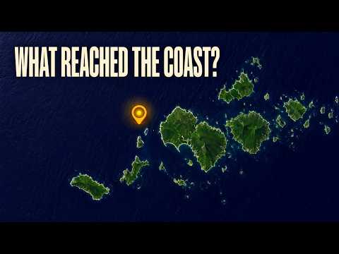
バヌアツ北部沖で発生した地震の初期評価では、人道的影響は小さいとされています。しかし、人的被害や住宅の損壊、重要なサービスの中断があったかどうかは、まだ分かっていません。震度IVの揺れがあった地域にいると推定される約4,000人にとって、この違いは、安心できる予測と実際に起きたことの報告を分けるものです。1 21
レビュー済みのマグニチュード6.3 mbの地震は、バヌアツ時間2026年10月24日午後1時35分57秒(UTC 02:35:57)、ポートオルリーの北西170キロで発生しました。深さは10キロと記録されています。国際災害警報調整システム(GDACS)も、マグニチュード、深さ、発生時刻を分単位まで裏付けています。1 21
もう一つの重要な不確実性は、沿岸の安全です。地震カタログには津波なしのフラグが付いている一方、GDACSは2つの波高欄に6センチメートルという値を掲載しています。どちらの記録も、沿岸地域に対する現在の指示を示すものではなく、バヌアツの国の当局によるこの地震に特化した指針も確認されていません。1 21 6
安心材料となる推定値が実際に意味すること
米国地質調査所の記録では、この地震に緑色のPAGER警報が割り当てられています。GDACSは、マグニチュード、人口の曝露、脆弱性に基づき、人道的影響の可能性を低いと評価し、スコアをゼロとしています。これらは予想される影響の評価であり、死傷者や損壊した建物の確定数ではありません。この評価でのゼロは、損失がゼロだったという報告ではありません。1 21
同様に、修正メルカリ震度階級IVの揺れにさらされた人が約4,000人という推定は、4,000人が負傷した、避難した、または支援を必要としたという意味ではありません。これは、揺れの強さを示す地域内の推定人口を表しています。影響を確認するには、これらの地域からの報告がまだ必要です。21
地震のマグニチュードと揺れの強さは、それぞれ異なる問いに答えるものです。レビュー済みのマグニチュードは6.3 mbです。この記号は実体波マグニチュードを示し、地球内部を伝わる地震波に基づいています。これをモーメントマグニチュードの測定値と、説明なく呼び替えるべきではありません。地震記録における最大推定震度は修正メルカリ震度階級で4.458で、地震そのものの規模ではなく、ある地点での揺れを表します。1
こうした違いが重要なのは、詳細な地震記録が実際以上に確定的に見えることがあるためです。正確な発生時刻と推定震度の分布から、地震がいつどこで起きたかは分かりますが、特定の建物、道路、通信サービスに損傷がなかったかどうかまでは分かりません。
カタログのフラグは指示ではない
津波情報にも同じ慎重さが必要です。GDACSは、最大波警報とリアルタイム最大波の両方の欄に0.06メートル、つまり6センチメートルと記載しています。この値に対応する観測所、沿岸の場所、観測記録は確認されていません。欄の名称にかかわらず、特定の海岸に到達した波の実測値と表現するのは適切ではありません。21
また、同システムに情報があるからといって、米国地質調査所(USGS)のカタログに津波なしのフラグが付いていることと、必ずしも矛盾するわけではありません。このフラグが運用上正確に何を意味するのか、またGDACSの波高値の出所は未解明です。こうした定義が分からない以上、沿岸住民が知る必要のある「今、どの指示に従えばよいのか」という問いへの、互いに競合する回答として2つの記録を扱うことはできません。1 21
ザ・ウォッチャーズは、地震活動全体に関する10月24日の報道で、太平洋津波警報センターが03:28 UTCに津波の脅威は去ったと発表したと伝えています。しかし、元の速報と、それがこの地震に適用されるかどうかは確認されていません。気象・地質災害局(VMGD)または国家災害管理局による、この地震に特化した指示や解除情報も確認されていません。11 6
VMGDの地震一覧には10月24日の日付が記載されていますが、勧告の発令時刻や現在の沿岸部への指示を示すものではありません。10月20日の地震後の安全に関する別の報道は、それ以前の地震についてのものであり、10月24日の安全宣言として扱うことはできません。6 24 25
複数の揺れ、未解明の地震活動
マグニチュード6.3の地震は、近隣で別個に確認されたほかの4つの地震の中に位置づけられます。EarthquakeTrackerの一覧では、それらの震源解はUSGSのレビュー済み記録に基づくとされていますが、周辺の地震について独立した一次情報による確認は得られていません。それぞれ異なる識別番号と発生時刻があるため、同じ地震の重複報道や更新情報とは区別できます。4つはいずれも深さ10キロと記録されています。5 9 8 7
近隣の地震(UTC)
- 10月23日 22:05:10 UTC5
EarthquakeTrackerは、ポートオルリーの北西203キロで発生したマグニチュード5.1 mwwの地震を掲載しています。
- 10月24日 00:27:44 UTC9
別の一覧には、ポートオルリーの北西195キロで発生したマグニチュード4.5 mbの地震が記載されています。
- 10月24日 02:35:57 UTC1
レビュー済みのマグニチュード6.3 mbの地震は、ポートオルリーの北西170キロで発生しました。
- 10月24日 03:08:45 UTC8
EarthquakeTrackerは、ポートオルリーの北西170キロで発生したマグニチュード5.1 mbの地震を掲載しています。
- 10月24日 03:17:55 UTC7
ポートオルリーの北西202キロで、マグニチュード5.2 mbの地震が記録されています。
これらの地震の公式な関係は確認されていません。それ以前の揺れを前震、後の揺れを余震と呼べば、確認済みの分類を超えることになります。マグニチュード6.3の一覧に付された別の06:36 UTCという時刻は、記録の更新時刻であり、別の地震ではありません。6 13
放送時の内容 16行
- A magnitude-six-point-three earthquake struck offshore from northern Vanuatu.
- About four thousand people are estimated to have been within an area of level-four shaking. The unresolved questions are the damage on land and the current safety guidance for coastal communities.
- The earthquake struck one hundred seventy kilometres northwest of Port-Olry, at a listed depth of ten kilometres. It happened on October twenty-fourth, twenty twenty-six, at about one thirty-five in the afternoon, local time.
- The reviewed magnitude is six point three on the body-wave scale, which uses seismic waves travelling through the Earth. The measurement is labelled m b. That label belongs with the magnitude when comparing this earthquake with others.
- About four thousand people fall within the estimated level-four shaking area. That gives the earthquake a human scale beyond its offshore location. The estimate counts people exposed to shaking; their actual circumstances still depend on what happened in their communities.
- Shaking intensity describes conditions at a particular location. The maximum estimated intensity is four point four five eight on the Modified Mercalli scale. Magnitude describes the earthquake itself, while intensity helps describe how its shaking reaches different places.
- The initial humanitarian assessment is low, with a score of zero. The earthquake also carries a green alert for expected impacts. Those assessments consider the earthquake's magnitude, the population exposed and people's vulnerability. They estimate consequences before local conditions are fully known.
- We still don't know whether anyone was hurt, or whether buildings and essential services were damaged. The low-impact assessment offers some reassurance, but communities' experiences are the information needed to understand the actual consequences.
- Port-Olry is the reference point for locating the offshore shock. For coastal communities, the practical concerns extend beyond shaking to tsunami instructions. The earthquake catalog and the disaster assessment contain different kinds of tsunami information, and each needs careful interpretation.
- Four other nearby earthquakes surround the six-point-three in time. They're listed as separate events, each with its own origin time and identifier. All four have listed depths of ten kilometres. Their official relationship to the six-point-three hasn't been determined.
- A magnitude-five-point-one shock and a four-point-five came before the six-point-three. A five-point-one and a five-point-two followed it. These are nearby shocks. Calling them aftershocks or foreshocks would require an official assessment of how the earthquakes relate to one another.
- A later update time attached to the six-point-three describes a change to its earthquake listing. The earthquake's origin time stays the same. A separate uncertainty concerns a larger magnitude mentioned in descriptions of the wider sequence.
- A magnitude-six-point-nine earthquake reportedly struck shortly before the six-point-three. Another sequence tally puts six-point-three highest in its reporting period. Different time windows, distinct earthquakes or a magnitude revision could explain the difference, but the larger event's identity remains unresolved.
- The tsunami catalog flag reads no. The disaster assessment also lists six centimetres in both its maximum-wave-alert and maximum-wave-realtime fields. We don't know whether that value came from a model or an observation, or which coast it might describe.
- A tsunami-threat-passed bulletin has also been reported for the wider sequence. Its application to this earthquake hasn't been confirmed. The catalog flag and the six-centimetre entry can't settle what instructions currently apply to people along the coast.
- Current event-specific instructions from Vanuatu's Meteorology and Geo-Hazards Department or National Disaster Management Office remain unclear. Safety statements about an October twentieth earthquake concern that earlier event. For October twenty-fourth, the humanitarian outlook is low, while conditions in affected communities and current coastal guidance still need confirmation.
情報源
25 件の情報源13 社のメディア
The Watcherswatchers.news2
Faultlineduskengineering.services1
inquirer.net1
iris.edu1
PMN | Pacific Media Networkpmn.co.nz1
SeismoWatchseismowatch.com1
UA.NEWSua.news1
vmgd.gov.vu1
情報源マップ
この報道の根拠をたどります。マップで情報のつながりを確認し、下のリンクから記事で引用された情報源を開けます。
記事を読む間に情報源マップを読み込みます。
翻訳更新:
改訂履歴
- r1初公開。