
灾害 · 橡树溪通行情况持续报道 · 第 2 篇,共 3 篇
两条公路重新开放,但塞多纳撤离居民仍未收到解除警报
洪灾后,17号州际公路和260号州道重新开放,但塞多纳当地安全路线、避难所接收情况,以及是否允许居民返回已撤离的街区,仍未确认。
原语言视频
文字实录 · 正在加载
译自英文原文。
持续报道第 1 天
3 篇报道40 家媒体67 个来源
完整报道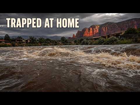


自上次报道以来的变化
12 小时后
现在
洪灾后,17号州际公路和260号州道重新开放,但塞多纳当地安全路线、避难所接收情况,以及是否允许居民返回已撤离的街区,仍未确认。
**两条公路重新开放,缓解了亚利桑那州洪灾造成的出行受阻——但都不意味着塞多纳撤离家庭已获准安全返回。**11月1日星期日下午,经过数小时封闭后,17号州际公路双向恢复通行。亚利桑那州时间下午4:30左右,松顶湖畔附近的260号州道重新开放。当地街道是否通行、前往避难所是否有安全路线,以及是否获准返家,仍是彼此独立、尚未解决的问题。7
在11月1日的报道中,我们报道了塞多纳东侧8、9和10区因橡树溪水位迅速上涨而立即撤离的情况,以及有人被困在家中的报告。公路重新开放是自那次报道以来的实质性变化。它们恢复了该地区的重要交通连接,但不能证明撤离区内的街道可以通行,也不能证明“立即撤离”指令已解除。县级警报印证了这三个区域的撤离情况,但目前没有经过核实的解除或替代命令。8
公路状况有哪些变化
此前,17号州际公路对北行车辆的限制设在179号州道处,南行车辆则在弗拉格斯塔夫普利亚姆机场附近的337英里路标处被拦停。AZFamily此前11月1日关于封路的报道,后来被FOX 10凤凰城台及其他地方媒体下午发布的重新开放消息取代。AZFamily更新后的报道也证实,双向所有车道均已重新开放。这是随时间发生的变化,并非各方对州际公路是否仍封闭意见不一。7 4
现有报道支持公路在下午重新开放,但无法确定官方记录的精确恢复通车时间。KNAU下午2:19 MST的更新已称所有车道重新开放;ABC15称交通部门在下午3点前不久发布了公告。报道发布时间和公告时间不应被误当作经核实的恢复通车时间。48 29
由于洪水,松顶湖畔附近350英里路标处的260号州道此前曾封闭。FOX 10此前11月1日的报道仍将该路段列为受限路段;AZFamily更新后的报道称该公路在下午4:30左右重新开放。后续消息取代了此前的封闭状态。4 7
AZFamily更新后的封路名单还列出另外三条路线,且未提供预计重新开放时间。目前这些路段的状况尚未通过带时间戳的交通部门事故记录独立确认。应将其描述为报道所称的交通限制,而非此刻仍封闭道路的经核实清单。7
与橡树溪走廊关系最直接的交通限制是塞多纳与卡奇纳村之间、双向封闭的89A号州道,路标375–397英里。该路段长22英里,通往弗拉格斯塔夫地区,并非89A号州道的全部路段。目前没有该路段经核实的重新开放时间,也没有获准使用的撤离绕行路线。7
名单中的其他限制路段包括:印第安派恩与怀特里弗之间、路标351–357英里的73号州道;以及马里科帕与吉拉本德之间的238号州道,报道未提供其路标范围。这些是亚利桑那州其他地区的独立路段,不能互相替代,用来穿过塞多纳被洪水淹没的街区或前往当地避难所。7
强降雨还引发了落石。交通部门工作人员使用除雪卡车清理亚利桑那州北部车道上的碎石杂物。这也是溪流水位下降不能证明道路安全的原因之一:水位回落无法表明碎石是否已清除、路面是否经过检查,或交通限制是否已解除。洪水还迫使白山阿帕奇部落土地上的居民撤离;坎普弗德另行下令撤离弗德河、韦斯特克利尔溪和韦特比弗溪附近地区。7 1
州际公路重新开放,恢复了一条交通连接;这并不能证明返家路线安全。
同一条溪流,读数却截然不同
晚间水位测量结果说明,为何不能用一个看似改善的数字概括这场紧急情况。星期日晚上7:45 MST,塞多纳的橡树溪水位为12.88英尺,低于14英尺的洪水警戒水位。科恩维尔晚上8点的读数为16.93英尺,而洪水警戒水位为8英尺——高出警戒线8.93英尺。2
早间观测结果截然不同:塞多纳上午7:45测得15.06英尺,科恩维尔上午8点测得8.88英尺。截至上午8:15,雷达和自动水位计显示警报区域降雨量为1.25至2.5英寸。这些新增的、随警报提供的观测数据补充了数字证据,而我们先前的报道尚未确认这些数据。它们是两个地点的瞬时读数,并非经核实的连续记录,也不是最终洪峰水位。8
公路状况变化见于更新后的地方媒体报道,而非直接获取的亚利桑那州交通部事故记录。溪流水位数据和预报来自所提供的美国国家气象局及县级警报材料;原始警报网页无法独立访问。在判断目前哪些道路开放,以及预测中的水位回落是否确已发生时,这些局限尤其重要。
11月1日晚上8:35 MST发布的洪水警报称,警报区域已发生洪水,道路封闭且无法通行,上游降雨可能导致夜间水位进一步上涨。警报预测科恩维尔将在星期日深夜达到洪峰,并于星期一上午晚些时候降至洪水警戒水位以下。警报没有指出受影响的道路,因此不能单独证实某条州道的具体状况。2
警报原定于11月2日星期一中午12点 MST到期。这是天气警报的截止时间,并非返家许可。此前的早间山洪警报原定于星期日上午11:15到期,同样不能证明撤离已经结束。预报水位回落或警报时限届满,都不能代替对“立即撤离”指令的正式更改。2 8
家庭仍需确认的事项
塞多纳消防区主管埃德·梅祖利斯表示,救援人员正在处理多起居民被困在家中的报告,周边社区的队伍也赶来协助。消防员召集了额外人手。现有报道仍未证实被困人数、完成的救援次数,也没有伤者、死亡、撤离家庭或财产损失的统计总数。缺少统计数字并不代表没有发生伤害。5 4
塞多纳红岩高中是指定的撤离安置地点。目前接收情况、开放时间、容量,以及前往学校的经核实安全路线仍未确认;三个区域可靠的街道级边界也未确认。公路重新开放无法填补这些信息空缺。8
播出原貌 18 行
- Interstate 17 has reopened in both directions, restoring travel after hours of flood closures. But families evacuated near Oak Creek still face flooded local roads and uncertainty about returning home.
- On November 1, we reported immediate evacuations in Sedona's east-side Zones 8, 9 and 10 as Oak Creek rose rapidly. The highway reopenings now change the travel picture around those neighborhoods.
- Which roads have reopened, and what does that mean for families trying to leave or return? State Routes 89A, 73 and 238 were reportedly still closed Sunday evening. Their current status isn't clear, and no reopening estimates were available.
- State Route 89A's restriction covered both directions between Sedona and Kachina Village, from milepost 375 to 397. That's a 22-mile span through the Oak Creek corridor toward Flagstaff, affecting a highway connection out of the Sedona area.
- The earlier Interstate 17 closures blocked northbound traffic at State Route 179 and southbound traffic near Flagstaff Pulliam Airport, at milepost 337. Those restrictions lasted hours before all lanes reopened Sunday afternoon. That reopening restores the interstate connection, while access within the flooded neighborhoods remains a separate problem.
- Interstate 17 moved from closures in both directions to all lanes reopened during the afternoon. The earlier restrictions belong to the history of this emergency. They shouldn't be counted as closures still in effect after the reopening.
- State Route 260 also reopened after flooding near Pinetop-Lakeside, around milepost 350. Traffic resumed around 4:30 p.m. Arizona time on November 1, superseding its earlier closed status. That adds a second reopening to the day's transportation changes.
- The other reported restrictions covered State Route 73 between Indian Pine and Whiteriver, from milepost 351 to 357, and State Route 238 between Maricopa and Gila Bend. Those are separate highway segments elsewhere in Arizona. They don't provide an authorized evacuation route through Sedona.
- Transportation crews used plow trucks to clear rockfall debris from northern Arizona travel lanes. Heavy rain created hazards beyond rising water. A lower creek reading alone can't tell drivers whether workers have cleared and inspected a road.
- Flooding also forced evacuations on White Mountain Apache tribal lands. Camp Verde separately ordered evacuations near the Verde River, West Clear Creek and Wet Beaver Creek. In Sedona, local street closures compounded the highway restrictions as emergency crews responded along Oak Creek.
- Radar and automated gauges indicated 1.25 to 2.5 inches of rain across the warned area by Sunday morning. Oak Creek's measurements then changed very differently at two locations. The morning and evening readings show why one observation can't describe conditions along the whole creek.
- At Sedona, Oak Creek measured 15.06 feet in the morning and 12.88 that evening. Its flood stage is 14 feet. Cornville rose from 8.88 to 16.93 feet, against an eight-foot flood stage.
- Cornville's evening reading stood 8.93 feet above flood stage. The weather service warned of flooding and impassable roads in Coconino and Yavapai counties, with further rises possible from upstream rain. Those measurements describe the creek at specific times; they don't clear a highway or cancel an evacuation.
- The evening Flood Warning was issued at 8:35 p.m. Sunday and scheduled to expire at noon Monday, November 2. The forecast called for Cornville to crest late Sunday night and fall below flood stage late Monday morning. Further overnight rises were still possible.
- Sedona Fire District Chief Ed Mezulis said crews were responding to multiple reports of people trapped inside homes. Firefighters called in extra personnel, and surrounding communities sent assistance. Officials directed evacuees to Sedona Red Rock High School.
- There still isn't a confirmed total of completed rescues or casualties. Current shelter intake and a safe route to the school haven't been confirmed. The county alert supports the three-zone GO instruction, but officials haven't provided a confirmed lifting or replacement order here.
- The two highway reopenings partly resolve the access question. Families still need official direction on local routes and returning home. A forecast of falling water, or a warning reaching its scheduled expiration, doesn't give residents permission to return.
- The earlier morning Flash Flood Warning had been scheduled to expire at 11:15 a.m. Sunday. That deadline also didn't end the evacuation instruction. Officials warned drivers against crossing flooded roads and residents against approaching washes or creek beds. People in immediate danger were directed to higher ground and told to call 911 when safe.
来源
49 个来源32 家媒体1 篇通稿
ABC15 Arizona in Phoenix (KNXV)abc15.com2
ArcGIS StoryMapsarcgis.com2
KNAU Arizona Public Radioknau.org2最先
National Weather Serviceweather.gov2
Arizona Daily Sunazdailysun.com1
Arizona Expressarizona-express.com1
az511.com1
azdot.gov1
Colorado Springs Gazettegazette.com1
floodriskhere.com1
FOX 10 Phoenixfox10phoenix.com1
Jacksonville Journal-Couriermyjournalcourier.com1
KGUN 9 Tucson Newskgun9.com1
roadconditions.com1
Rolling Outrollingout.com1
Sedona Red Rock Newsredrocknews.com1
Storm Station 247stormstation247.com1
Telemundo Phoenix/Tucsontelemundoarizona.com1
WHEC.comwhec.com1
来源地图
追溯本篇报道的依据。图谱展示其关联;下方链接可打开本文引用的来源。
来源图谱将在您阅读时加载。
译文更新于
修订记录
- r1首次发布。