
灾害 · Oak Creek洪水持续报道 · 第 3 篇,共 3 篇
Oak Creek水位大幅下降,但塞多纳撤离居民仍只能部分返家
11月2日的读数显示水位大幅回落,一些居民也获得了有条件的通行许可。但街道限制和之后关于89A州道封闭的报道,都不足以证实11月4日已全面解除限制。
原语言视频
文字实录 · 正在加载
译自英文原文。
持续报道第 4 天
3 篇报道40 家媒体67 个来源
完整报道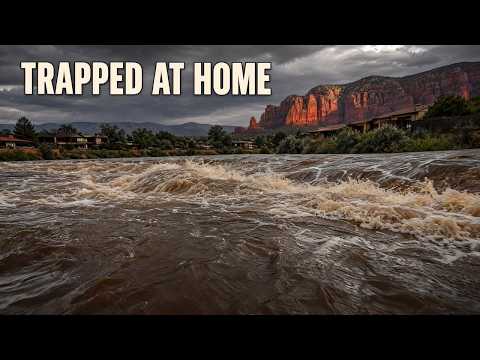


自上次报道以来的变化
2 天后
现在
11月2日的读数显示水位大幅回落,一些居民也获得了有条件的通行许可。但街道限制和之后关于89A州道封闭的报道,都不足以证实11月4日已全面解除限制。
塞多纳 Oak Creek 洪水紧急事件的下一章,并非警报解除。11月2日,HeyDay News 报道称,前一天早上,东侧的8、9和10区已接到撤离命令,据报有居民被困在家中,紧急救援人员正在响应。随后对溪流水位的测量显示,水位在夜间大幅回落。之后发布的通行情况更新则描述了远未全面恢复的状况:有条件返家、街道仍然封闭,以及一条仍受限制的峡谷公路。
到11月4日,这一区别至关重要。现有报道证实,撤离紧急事件后情况已有明显改善,但并未证实目前有一条不受限制的返家路线。11月2日的一则更新允许居民在设有检查站和例外限制的情况下返回大多数撤离区域;11月3日的一篇报道仍称89A州道因安全原因封闭。这两者都不能证实11月4日每个撤离区或每条道路的官方状态。65 63
溪流水位下降,但有两条不同的警戒线
最明确的水位回落测量结果来自2026年11月2日清晨。在塞多纳下游的Cornville,Oak Creek于山地标准时间凌晨5时水位为10.57英尺,仍高于当地洪水水位警戒线2.57英尺。在塞多纳,凌晨4:45的读数为7.06英尺,低于当地的洪水水位警戒线,但美国国家气象局的警告仍称当地处于行动水位状况。这些是有日期的观测结果,并非11月4日的水位。3
关键事实
两个水位计各有自己的危险水位线。塞多纳的水位低于洪水警戒线,不能证明下游Cornville的洪水已经退去。任何一个读数都不能证明某个特定的渡口、车道或桥梁可以通行。
我们此前的报道记录了11月1日晚间的观测值:Cornville为16.93英尺,塞多纳为12.88英尺。与次日早晨的读数相比,Cornville水位下降了6.36英尺,塞多纳下降了5.82英尺。这些是幅度显著的变化,分别以同一水位计的读数进行比较,并非比较两个地点之间的差异。
这些数据证实两次观测之间水位有所回落,但不能确定洪峰的准确高度或出现时间。我们此前的报道曾提到,预计洪峰将在周日深夜抵达Cornville;仅凭周一早晨水位较低,并不能确认预测确实完全按预期实现。
美国国家气象局早间发布的警告涵盖科科尼诺县和亚瓦派县的Oak Creek。警告于11月2日山地标准时间上午5:39发布,评估时间戳比发布早三分钟;警告在指出水位下降的同时,也明确描述了道路危险。3
洪水导致道路封闭、无法通行。低水位渡口发生致命洪水。
该警告没有列出所有受影响的道路,也没有提供逐街封闭清单。它更基本的意义在于:溪流水位可能正在下降,但道路仍可能无法通行。水位计测量的是所在位置的水位;它无法告知驾驶者洪水在返家路线上留下了什么。
警告时间线也延续到了早间通知所定的中午到期时间之后。WarningVector 保存的一份后续通知显示,该通知于11月2日美国山地标准时间下午4:53发布,称警告将在下午5时到期,并描述了两个水位计读数均在下降。现有记录无法证实中午到下午4:53之间的延期情况。任何一个预定到期时间都不能证明截至11月4日是否另有警告生效。57
获准进入,不等于道路畅通
对流离失所的居民而言,更重要的变化是他们有了附带条件的返家机会。Watch Duty一则标注日期为11月2日下午4:45、但未注明时区的更新称,居民可在检查站出示居住证明后返回大多数撤离区域。Blackhawk Lane、Trails End Drive或Lane以及Bear Wallow Lane仍然封闭。65
这与最初要求立即撤离的指令相比,是一个重要变化。但这并不等于已核实逐区撤销了对8、9和10区的强制撤离状态,也不能证明同样的安排一直持续到11月4日。把最初的撤离令重述为已确认仍然有效的当前指令,会夸大现有记录;宣布全面畅通、解除警报,也同样会夸大记录所能证实的情况。
公路通行则是另一项障碍。KTAR在11月3日报道称,89A州道仍因安全原因封闭。AZFamily将受影响路段界定为塞多纳与Kachina Village之间的双向路段,里程标记为375至397。这是Oak Creek Canyon走廊,并非89A州道全线。63 66
现有证据中,没有带时间戳的官方交通通告能够证实11月4日这条公路的状况或准确开放时间。11月3日的封路报道是有日期的参考信息,并非实时道路状态公告。同样,获准进入某个撤离社区,并不意味着通往该社区的公路已经开放。
最初紧急事件造成的人身后果也仍缺乏完整记录。塞多纳消防区负责人Ed Mezulis曾表示,救援人员正在响应多起居民被困家中的报告。Your Valley和The Guardian随后也报道了居民被困的情况,但没有提供已完成的救援总数。现有证据没有证实伤者、死亡人数或财产损失总额;缺少这些统计数字,不能据此宣称所有人都安然脱险。26 1 2
塞多纳红岩高中此前被指定为撤离人员的安置地点。该校目前是否接收人员、开放时间、接收能力以及经核实的安全路线,均未得到确认。返家通行情况更新没有回答这些安置问题。7
对居民而言,不能把四项进展混为一谈:溪流水位下降、天气警告到期、获准返家,以及道路可以通行。记录显示,第一项有所进展,第三项发生了有条件的变化。但记录仍未提供按社区划分的当前清场确认,无法据此认定返家行程已经稳妥。
播出原貌 16 行
- Oak Creek fell more than six feet overnight but still flooded Cornville.
- On November 2, we reported that Sedona had ordered east-side Zones 8, 9 and 10 evacuated the previous morning. Multiple residents were reported trapped in homes, and emergency crews were responding. The later measurements show how far the water subsequently fell.
- Families trying to get home still faced street restrictions and a highway closure after that improvement. How much did falling water actually change their access?
- Cornville sits downstream from Sedona along Oak Creek. The flood warning covered the creek in Coconino and Yavapai counties. Separately, the reported highway restriction ran between Sedona and Kachina Village through Oak Creek Canyon, affecting a specific stretch of State Route 89A.
- Cornville's flood threshold is eight feet. Sedona's is fourteen feet. Each gauge measures conditions at its own location, so the two heights need their own danger lines. A lower reading at Sedona couldn't settle whether flooding had ended downstream, or whether a particular crossing was usable.
- Cornville measured 10.57 feet early on November 2, still 2.57 feet above its eight-foot flood stage. Sedona measured 7.06 feet, below its fourteen-foot flood stage. But the weather warning still described action-stage conditions there, calling for continued attention as the water fell.
- Those are November 2 observations. They describe the recession after the evacuation emergency. At Cornville, water remained above minor flood stage even after a substantial overnight drop. At Sedona, the warning's continued action-stage assessment also gave residents reason to keep watching conditions despite the lower measurement.
- Cornville dropped from 16.93 feet to 10.57 feet overnight, a fall of 6.36 feet. Sedona dropped from 12.88 feet to 7.06 feet, down 5.82 feet. Both changes compare the same gauge on November 1 and November 2.
- Those measured drops show that the creek was receding between observations. They leave the exact crest unresolved. A gauge also can't tell a driver whether floodwater has left debris on a road or whether a driveway or bridge is safe. The morning warning gave a direct description of the danger.
- Floodwater still made roads impassable, and low-water crossings could be deadly. The morning weather warning was scheduled to last until noon on November 2. A later notice that afternoon described falling levels at both gauges and set expiration for five p.m.
- The later notice moved the warning timeline beyond that morning's noon deadline. But a weather warning's scheduled expiration doesn't give residents permission to re-enter an evacuated neighborhood. Local return decisions and road access still have to line up. By that afternoon, some residents did have a qualified way back.
- Residents could reportedly return to most evacuated areas on November 2 with proof of residency at checkpoints. Blackhawk Lane, Trails End Drive or Lane, and Bear Wallow Lane remained closed then. That gave some displaced residents access while keeping restrictions on particular streets.
- Emergency crews had faced multiple calls about residents trapped in homes during the initial flooding. We still don't know how many people were rescued or whether anyone was hurt. The return arrangements described a significant change from the earlier evacuation instructions, but they gave residents only conditional access.
- State Route 89A was still reportedly closed for safety on November 3. The affected stretch ran in both directions between Sedona and Kachina Village, from milepost 375 to milepost 397. That restriction covered the canyon corridor rather than the highway's entire length.
- Sedona Red Rock High School was the earlier designated evacuation destination. Its present operating status is unclear. For November 4, the official return status of each evacuation zone and the highway's reopening status are still unresolved. The dated access changes don't amount to an unrestricted all-clear.
- Officials told people in immediate danger to move to higher ground and call 911 when safe. They also warned residents to avoid washes and creek beds, and never drive through flooded roads.
来源
67 个来源40 家媒体1 篇通稿
AZ Familyazfamily.com4
KTAR.comktar.com4
National Weather Serviceweather.gov4
- 首次报道于
- Flood Warning issued November 2 at 5:39AM MST until November 2 at 12:00PM MST by NWS Flagstaff AZ
- Flood Warning issued November 1 at 8:35PM MST until November 2 at 12:00PM MST by NWS Flagstaff AZ
- WWA Summary for Flood Warning
- WWA Summary by Location for 34.31N 111.95W with AZZ037/AZC025/AZZ137 emphasis Flood Watch
forth.news3
- Flash Flood Warning issued November 1 at 8:15AM MST until November 1 at 11:15AM MST by NWS Flagstaff AZ | National Weather Service | Forth
- Evacuation Immediate Alert from AZCoconinoCountyDepartmentofEmergencyManagement | Emergency Alerts | Forth
- FLOOD WARNING REMAINS IN EFFECT UNTIL NOON MST TODAY | National Weather Service | Forth
ABC15 Arizona in Phoenix (KNXV)abc15.com2
ArcGIS StoryMapsarcgis.com2
KNAU Arizona Public Radioknau.org2最先
Arizona Daily Sunazdailysun.com1
Arizona Expressarizona-express.com1
az511.com1
Colorado Springs Gazettegazette.com1
floodriskhere.com1
FOX 10 Phoenixfox10phoenix.com1
Jacksonville Journal-Couriermyjournalcourier.com1
KGUN 9 Tucson Newskgun9.com1
Nivelmapnivelmap.com1
roadconditions.com1
Rolling Outrollingout.com1
Sedona Red Rock Newsredrocknews.com1
Sedona.Biz - The Voice of Sedona and The Verde Valleysedona.biz1
Storm Station 247stormstation247.com1
Telemundo Phoenix/Tucsontelemundoarizona.com1
The Guardiantheguardian.com1
Visit Sedonavisitsedona.com1
Warning Vectorwarningvector.com1
- 首次报道于
- Flood Warning
Watch Dutywatchduty.org1
WHEC.comwhec.com1
Your Valleyyourvalley.net1
来源地图
追溯本篇报道的依据。图谱展示其关联;下方链接可打开本文引用的来源。
来源图谱将在您阅读时加载。
译文更新于
修订记录
- r1首次发布。