灾害 · Rachel残余环流持续报道 · 第 1 篇,共 2 篇
Rachel残余环流致长滩住宅倒塌,洪水救援蔓延至内陆
海滨护岸失效,导致长滩住宅倒塌、居民流离失所,内陆洪水则困住了民众。Rachel转为后热带系统,并不意味着安全无虞。
原语言视频
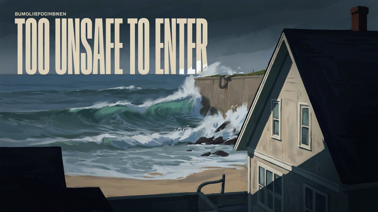
文字实录 · 正在加载
译自英文原文。
持续报道第 3 天
2 篇报道44 家媒体78 个来源1 个视频
完整报道
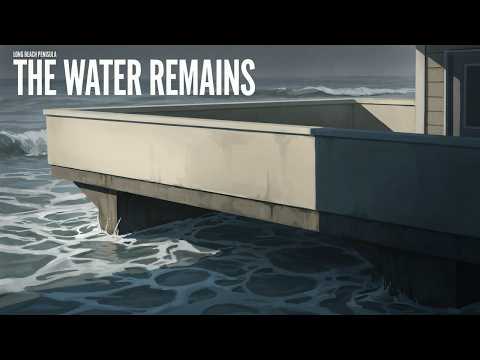
10月11日,长滩东海滨步道沿线的临海住宅倒塌,海浪不断涌过一段已失效的护岸。原本用于保护海滨的墙体已经坍塌,海水仍在持续涌来。当天拍摄的照片显示了造成的后果;另有报道称,64号与65号路之间的木板步道进一步坍塌。2 7
Rachel的残余环流已使沿海洪水威胁演变为居民流离失所和房屋修缮问题,其影响将持续到降雨结束之后。长滩官员报告称,13处临海住宅因危险而禁止进入。内陆方面,ABC新闻报道称,两人从圣贝纳迪诺一处被淹的雨水排水渠中获救;拉斯维加斯发生车辆被水淹的情况,并因此实施救援。风暴转为后热带系统,并不意味着这两种危险已经消失。9 1
关键事实
我们在10月11日发布的展望关注的是南加州可能出现强浪和洪水。之后的报道记录了实际发生的损毁和救援,而不仅仅是风险。但这还不是最终统计:目前尚未核对出统一的死亡或受伤人数、全面的救援次数,也没有完整的受损住宅清单。没有伤亡统计,并不证明无人受伤。
潮位有所降低,但住宅仍不安全
在长滩半岛地区,强制疏散区域包括海滨步道6400号和6500号街区。10月11日上午的报道说,在海浪越过护岸后,这两个街区的住宅仍受疏散令约束。目前尚未确认有之后允许居民返回的通知。红色禁入标记意味着受影响住宅被判定为进入过于危险,而不只是被水浸湿、令人不便。9 3
损毁在星期日之前就已开始。ABC7在一篇标注日期为10月10日的文章中,已经报道有住宅被贴上红色禁入标记,其中一栋有坠入海中的危险;但其发布元数据显示日期为10月9日。这一日期差异使最初发生损毁和疏散的时间仍无法确定。可以确定的是,星期日的损毁属于一场持续中的紧急事件。10
《黄金海岸日报》报道称,星期日上午的潮位低于预报,也低于星期六的潮位。然而,护岸失效后,海浪仍不断淹没并损坏住宅。潮位降低无法修复已破损的海岸防护设施、稳固不安全的房屋,也无法恢复已经坍塌的步道。3 7
红色禁入标记的数量也必须保留原有统计单位。KTLA援引长滩官员的话称,有13处不安全的临海住宅;The Southbound 105则在标题中使用了8栋建筑这一数字。第二篇报道的时间和统计依据不清楚。建筑物和住宅不一定是同一种统计单位,因此不能负责任地将这些数字解读为又有5处住宅变得不安全。两篇报道都没有提供完整的市政住宅检查清单。9 39
纽波特海滩也关闭了海滨区域。10月9日星期五,在巴尔博亚半岛发生洪水后,该市宣布进入地方紧急状态,并敦促居民保护住宅和财产。到10月11日,ABC新闻报道称,纽波特海滩所有海滩和码头均已关闭。关闭的确切起始时间、是否一直持续以及重新开放时间尚未确定。40 35 5
ABC在10月12日的报道中还称,纽波特海滩正在设置至少10英尺高的防护屏障。这一高度尚未得到独立证实,具体地点和施工材料也仍不清楚。10英尺指的是报道所说的屏障高度,并非实测海浪、风暴潮或建筑物高度。强浪和沿海洪水已得到证实;但沿海水位的精确数字尚无定论。1
内陆水患阻断逃生之路
据ABC新闻报道,在圣贝纳迪诺,两人被困在一处雨水排水渠内,后来都被救出。报道于10月12日发布,但发布日期无法确定救援发生的时间。目前没有主要事故记录能够确认排水渠的具体位置、响应机构、事故时间或获救者的状况。ABC还报道称,拉斯维加斯发生严重洪水,汽车受困并有人获救,但没有经核实的全市救援总数。1
一场地点记录更为精确的救援发生在10月11日星期日上午约8:50,地点位于温彻斯特的多梅尼吉尼公园大道与利昂路附近。MyNewsLA报道称,河滨县消防人员将一辆被困在积水道路上的车辆中的一名乘员护送至较高处,当时水位仍在上涨。报道没有说明这名乘员是男性,也没有说车辆被水冲走。27
MyNewsLA报道称,那个星期日河滨县有两名驾车者获救,其中包括温彻斯特的那名乘员,但现有细节只描述了这起事故。另据ABC报道,一名男子在汽车被水冲走后从洪水中获救,报道将地点写作“Paris”。这一地点尚未得到核实。加利福尼亚州的佩里斯(Perris)可能是值得查证的拼写,但尚不能据此认定报道有误;也没有依据把救援地点说成法国巴黎。这些报道可能指向同一事件,不能相加得出更大的总数。27 1
降雨报告显示内陆地区降水量可观,但测量时段信息不完整。《加利福尼亚人报》报道称,星期六至星期日清晨,圣迭戈县山区的降雨量超过3英寸。《黄金海岸日报》报道称,帕洛马山降雨量最高达5.16英寸。两家媒体都没有提供测量站点和完整的累积时段,因此无法将这些数字称为经核实的单日或整个风暴期间总降雨量。帕洛马山位于更广阔的山区范围内,因此这两组数字有所重叠,不能相加。另有报道称,星期日黎明前圣迭戈县发生多起涉水救援,但没有给出确切数量。6 8 19
预报并不意味着一切安全
美国国家气象局圣迭戈办公室于10月11日太平洋夏令时凌晨3:18发布的一份当地声明称,Rachel的残余环流继续给下加利福尼亚州部分地区和美国西南部带来大雨及阵风。声明在其相应栏目下没有列出当前有效的观察或警报,并称这些观察和警报均已取消。取消这些项目并不等于所有单独发布的洪水或沿海灾害预警产品也都已取消。21
拉斯维加斯较晚发布的预报讨论于10月11日太平洋夏令时下午4:10发布,仍提示内华达州克拉克县和林肯县以及亚利桑那州莫哈维县的山洪风险较高,持续至星期日夜间。预报称,零星阵雨将持续到10月12日星期一,南风阵风将逐渐减弱。这些是标明日期的预报时段,并不能证明之后发生了更多洪水,也不意味着内华达州和亚利桑那州所有地区目前都处于警报之下。20
ABC称,Rachel的残余环流与另一股正在进入的天气系统相互作用,并向北移动,影响犹他州、亚利桑那州和内华达州的部分地区。第二个天气系统的身份及其与Rachel的具体相互作用尚未得到确认;犹他州是否发布了有明确有效时段的专项警报也未得到确认。目前提供的10月12日公告中,没有一份能说明夜间及星期一的预报后来发生了怎样的变化。1
未知
- 最终伤亡和损失数字、夜间及星期一的后续影响,以及当前疏散和关闭状态,仍未确定。
后续
- 应关注检查和重新开放通知,而不只是风暴分类变化,以确认居民何时可以返回、海滨何时可以重新开放。
本报道的来源与报道依据
ABC新闻:“数百万人严阵以待,应对暴雨和山洪。”1《洛杉矶时报》:长滩受损住宅和木板步道。2《黄金海岸日报》:半岛地区疏散和星期日潮汐。3Wave Briefing:沿海影响和救援行动。4ABC新闻:纽波特海滩关闭情况。5
《加利福尼亚人报》:南加州降雨和洪水。6Long Beach Post:半岛地区损毁和修缮。7《黄金海岸日报》:降雨、关闭情况和沿海预警。8KTLA:长滩不安全住宅。9ABC7:半岛地区被贴上红色禁入标记的住宅。10LAist:居民努力挽救住宅。11
美国国家气象局拉斯维加斯办公室天气简报。12ABC新闻:后热带风暴Rachel影响美国西南部。13Rolling Out:纽波特海滩洪水和内陆警报。14The Weather Channel:区域性灾害。15KESQ:道路被淹。16Fox Weather:美国西部洪水、降雨和大风。17GPB:Rachel降级。18ArcaMax:圣迭戈县降雨和救援。19
美国国家气象局拉斯维加斯办公室预报讨论。20美国国家气象局圣迭戈办公室当地声明。21美国国家气象局飓风当地声明页面。22美国国家飓风中心后热带风暴Rachel预报讨论。23NBC 7 San Diego:取消热带风暴观察后仍存在的灾害。24Las Vegas Sun:两场风暴带来的区域风险。25美国国家气象局洛杉矶/奥克斯纳德办公室页面。26
播出原貌 19 行
- Waves collapsed beachfront homes in Long Beach. Residents have been forced out of unsafe homes, while inland flooding has trapped people in vehicles and a storm drain. Rachel’s remnants are leaving damage along the coast and disrupting roads across parts of the Southwest. How long will the danger last for evacuated residents and people facing flooded roads?
- Waves kept flooding and damaging Peninsula homes on October 11 after a bulkhead failed. A bulkhead is a protective wall along the waterfront. Along East Seaside Walk, homes collapsed, and the boardwalk suffered further collapse between 64th and 65th Place.
- Rachel is now post-tropical, meaning it has lost its tropical storm structure. Its remnants still carry heavy rain and gusty winds. They’re interacting with another incoming weather system, bringing two different hazards. Coastal waves and high water batter waterfront protection, while inland rain overwhelms roads and drainage channels.
- Long Beach officials counted 13 beachfront residences red-tagged as too dangerous to enter. Residents can’t safely return to those homes. The failed coastal protection and damaged boardwalk also leave a repair problem that extends beyond clearing water from the streets.
- The evacuation area included the 6400 and 6500 blocks of Seaside Walk. Homes on those two blocks remained under mandatory evacuation orders on the morning of October 11, after waves overtopped the bulkhead. There’s no confirmed announcement allowing those residents back.
- Another red-tag tally gives eight buildings. That uses a different unit from the 13 residences, and the timing is unclear. The two figures can’t tell us whether five more homes became unsafe. A final count of damaged or destroyed homes isn’t available.
- Homes were already being red-tagged before October 11, including one at risk of falling into the ocean. Sunday morning’s tide was lower than forecast and below Saturday’s. But waves continued damaging homes after the bulkhead failed, leaving residents displaced even as the tide eased.
- Newport Beach closed all its beaches and piers amid unusually high ocean water. The city declared a local emergency on October 9 after flooding on the Balboa Peninsula, and urged residents to protect their homes and property. The waterfront closures were in place by October 11.
- Protective barriers at least 10 feet tall were reportedly being erected in Newport Beach. That height hasn’t been confirmed. It describes the barriers themselves. Heavy surf and coastal flooding damaged the waterfront, but there’s no confirmed numerical measurement of the waves or surge.
- Inland flooding also put people in immediate danger. In San Bernardino, two people became trapped inside a storm drain as water flooded it. Rescuers brought both out. In Las Vegas, severe flooding stalled vehicles and prompted rescues.
- Water interrupted movement across streets and drainage routes, and people needed help getting out. There’s no complete regional rescue count or settled death and injury total. Several water rescues were also reported in San Diego County before dawn on October 11.
- Riverside County Fire rescuers escorted one vehicle occupant to higher ground in Winchester on October 11. The vehicle was trapped on a flooded road near Domenigoni Parkway and Leon Road. Water was rising around it when rescuers helped the occupant out that morning.
- Two motorists were reportedly rescued in Riverside County that Sunday, including the Winchester occupant. Separately, a man was reportedly pulled from floodwater after his car was swept away, but his rescue location is unclear. Those incidents may overlap, so they can’t be added into a larger rescue total.
- San Diego County’s mountains reportedly received more than three inches of rain, with up to 5.16 inches on Palomar Mountain. The measurement periods aren’t specified. Palomar lies within the broader mountain area, so those figures overlap and can’t be added together.
- Rain fell across those mountain areas Saturday into early Sunday. Farther inland, the heaviest rain Sunday morning fell in parts of the southern Great Basin and Arizona’s Mohave County. The weather danger continued even after Rachel’s tropical watches and warnings were canceled.
- Rachel’s local tropical alerts had ended by early Sunday, but heavy rain and gusty winds continued across parts of Baja California and the southwestern United States. Separate flood and coastal alerts have their own schedules. Canceling the tropical alerts didn’t end those hazards.
- Flash-flood risk stayed elevated in the Sunday afternoon forecast for Clark and Lincoln counties in Nevada, and Mohave County in Arizona. That outlook covered Sunday night. Scattered showers were forecast to continue through Monday, October 12, with gusty south winds gradually tapering.
- The same forecast called for below-normal temperatures, including freezing conditions in parts of the southwestern Great Basin early in the workweek. Sunday’s outlook also included isolated thunderstorms and moderate-to-heavy rain. The broader outlook took Rachel’s remnants north toward parts of Utah, Arizona and Nevada.
- The October 11 forecast kept further inland flooding possible overnight and into Monday. A later bulletin hasn’t clarified how that risk changed. Long Beach’s evacuated residents still need clearance to return safely, and Newport Beach hasn’t confirmed when its closed beaches and piers can reopen.
来源
41 个来源26 家媒体1 个视频1 篇通稿
Los Angeles Timeslatimes.com4
- 首次报道于
- Heavy surf, red-tagged homes, a battered boardwalk: Long Beach confronts costly climate reality
- Tropical Storm Rachel: Long Beach evacuated, Newport Beach closes beach
- Newport Beach, other coastal spots hit by flooding prepare for more damage
- Tropical Storm Rachel, Kelvin wave, high tides combined to batter SoCal coast
GOES Image Viewer - NOAA/NESDIS/STAR websitenoaa.gov3
The Golden Coast Journalgoldencoastjournal.com3
FOX Weatherfoxweather.com1
Georgia Public Broadcastinggpb.org1
KESQkesq.com1
KTLAktla.com1
Las Vegas Sunlasvegassun.com1
Mohave Countymohave.gov1
NBC 7 San Diegonbcsandiego.com1
Newport Beach Newsnewportbeachindy.com1
Rolling Outrollingout.com1
The Weather Channelweather.com1
thecalifornian.com1
thesouthbound105.blogspot.com1未经核实的网站
来源地图
追溯本篇报道的依据。图谱展示其关联;下方链接可打开本文引用的来源。
来源图谱将在您阅读时加载。
译文更新于
修订记录
- r1首次发布。