災害 · 竜巻監視
竜巻監視681号、対象をバージニア州の4郡とエンポリアに縮小
10月11日午後6時12分(米東部夏時間)時点で、陸域の継続対象にはバージニア州の4郡とエンポリアが含まれていた。限定された河川区域では脅威が続いており、午後8時が終了予定時刻だった。全面解除ではない。
原語の動画
文字起こし · 読み込み中
英語の原文から翻訳されています。
ニュースの経過6日目
1 件のレポート90 社のメディア223 件の情報源

竜巻監視区域が縮小した後も、何に注意すべきなのか。竜巻監視681号では、夕方早い時間帯の答えはバージニア州の4郡、独立市エンポリア、そして大幅に絞られた水域のリストだった。警報開始時に示された広範な沿岸地域ではない。
2026年10月11日午後6時12分(米東部夏時間)時点で、監視は午後8時に終了する予定のままだった。延長も全面解除も確認されていなかった。ウェイクフィールド気象予報事務所が夕方遅くに継続対象とした陸域は、ブランズウィック、ディンウィディー、グリーンズビル、メクレンバーグの各郡とエンポリアだった。竜巻が発生する可能性は残っていたが、監視が出ていること自体は、竜巻が発生したことを示すものではない。17 28
午後の警報を夕方の行動計画と照らし合わせる人にとって、重要なのはこの区別だ。当初の対象範囲から分かるのは、監視がどこで始まったかであり、必ずしもどこに残っているかではない。対象範囲が縮小しても、その中にいる人には引き続き備えを促す警報であり、予定された期限を過ぎればすべての気象上の危険が終わるという保証ではない。
夕方も脅威が残った地域
米国立気象局ウェイクフィールド事務所は、米東部夏時間午後4時51分に監視681号について、「本日夕方午後8時まで有効」とする継続通知を出した。通知は残る陸域を「5郡」としたが、列挙された管轄区域は4郡と1つの独立市だった。エンポリアは合計には含まれるが、郡の数には含まれない。17
チェイスシティ、クラークスビル、ローレンスビル、サウスヒルは、継続対象地域内のコミュニティとして挙げられていた。これらの地名は住民が自分の位置を確認する助けになるが、監視対象に別の郡を追加するものではない。17
監視681号の対象範囲が狭まる
- 10月11日、午後1時55分(米東部夏時間)1425
ストーム・プレディクション・センターがノースカロライナ州東部、バージニア州南東部、沿岸水域の一部に竜巻監視681号を発令。
- 10月11日、午後1時56分(米東部夏時間)12
ウェイクフィールドが陸域と海域の地域向け通知を発出。終了予定は午後8時(米東部夏時間)。
- 10月11日、午後4時51分(米東部夏時間)17
ウェイクフィールドの陸域継続通知に、ブランズウィック、ディンウィディー、グリーンズビル、メクレンバーグの各郡とエンポリアを記載。
- 10月11日、午後5時50分(米東部夏時間)58
SPC状況報告第2号に、同じバージニア州の管轄区域と限定的な河川区域を記載。危険情報にはノースカロライナ州の陸域の郡は含まれず。
ストーム・プレディクション・センターの第2次状況報告は、米東部夏時間午後5時50分から6時40分までの有効期間について、脅威が続く海域として、パムリコ川とパンゴ川、ニュース川とベイ川、ヨーク川を挙げた。区域コードはAMZ136、AMZ137、ANZ636だった。別の海域継続通知では、ノースカロライナ州の残る水域が対象とされた。58 17
それより前の状況報告は、午後5時45分から6時40分まで有効で、バージニア州の5つの管轄区域や、オレゴンインレットからケープルックアウトまでの沿岸区間を含む、より広い海域のリストとともに、ノースカロライナ州オンスロー郡もまだ記載していた。次の報告では、対象範囲がさらに絞られた。58
ただし、この変更から分かることには限界がある。SPCは状況報告が指針であると明記し、監視が解除された郡、独立市、海上区域についての公式情報は、地域ごとのウォッチ・カウンティ・ノーティフィケーション(監視対象郡通知)で確認するよう読者に案内している。指針から郡名が消えただけでは、その郡に対する公式な解除通知にはならない。バージニア州の陸域継続通知は対象を具体的に示している。それ以外の地域にいる人は、状況報告を代替情報として扱うのではなく、最新の地域向け警報を確認すべきだ。58
当初の対象リストが異なって見えた理由
監視681号は米東部夏時間午後1時55分にストーム・プレディクション・センター(SPC)が開始し、ウェイクフィールドの地域向け通知はその1分後に出された。この隣接する時刻は同じ監視を示しており、競合する2つの警報ではない。どちらも終了予定時刻は同じで、10月11日午後8時(米東部夏時間)、協定世界時では10月12日午前0時だった。14 1 2
バージニア州の当初の表記についても、数え方を訂正する必要があった。「26郡」とされたが、実際は26の管轄区域、すなわち12郡と14の独立市だった。郡はブランズウィック、チャールズシティ、ディンウィディー、グリーンズビル、アイル・オブ・ワイト、ジェームズシティ、メクレンバーグ、プリンスジョージ、サウサンプトン、サリー、サセックス、ヨークの各郡だった。2 25
独立市はチェサピーク、コロニアルハイツ、エンポリア、フランクリン、ハンプトン、ホープウェル、ニューポートニューズ、ノーフォーク、ピーターズバーグ、ポクォソン、ポーツマス、サフォーク、バージニアビーチ、ウィリアムズバーグだった。これらは26の内数であり、さらに14カ所を加えるという意味ではない。この当初のリストは午後の発表時点での過去の対象範囲であり、夕方の陸域継続対象ではない。25
ノースカロライナ州の当初の2つの合計数も、地理的な対象範囲が異なっていた。ウェイクフィールド管轄分は、バーティー、カムデン、チョワン、カリタック、ゲイツ、ハートフォード、ノーサンプトン、パスコタンク、ペルキマンズの9郡だった。SPCの全体的な対象範囲にはこの9郡に加え、ボーフォート、カータレット、クレイブン、デア、ハイド、ジョーンズ、マーティン、オンスロー、パムリコ、ティレル、ワシントンの各郡が含まれ、ノースカロライナ州の合計は20郡だった。9郡と20郡の違いは管轄事務所の対象範囲によるもので、同じリストについての見解の相違ではない。2 25
当初の海上向け通知も、対象範囲を明確に示していた。チェサピーク湾のうち、ニューポイントコンフォートからリトルクリークまでの区間と、リトルクリークからケープヘンリーまでの区間(チェサピーク湾ブリッジ・トンネルを含む)、カリタック湾、ヨーク川が対象だった。ジェームズ川はジェームズタウンからジェームズリバーブリッジまで、さらに同橋からハンプトンローズブリッジ・トンネルまでの区間(エリザベス川を含む)が対象だった。沖合は、ケープチャールズ灯台からバージニア州とノースカロライナ州の州境まで、さらにカリタックビーチ灯台までの各区間で、それぞれ沖合20海里までが対象だった。1
これらは境界線であり、観測地点ではない。川や湾が対象に挙げられていても、そこで竜巻や水上竜巻が目撃されたという意味ではない。また、「沖合20海里まで」は沿岸の監視区域を定めたものであり、嵐から離れるべき推奨距離ではない。
今すぐ備え、警報が出たら行動を
監視は、その危険が発生しやすい状況にあり、警報に備えるべきだという意味だ。警報は、現象が差し迫っている、または近隣で発生中という意味で、身を守る行動を求める。ウェイクフィールドの公式基準は、その指示を明確に示している。「命と財産を守るために行動してください」11
対象地域にいる人に対し、米国立気象局(NWS)は、緊急時の計画を確認して話し合うこと、備蓄品を点検すること、安全な部屋の準備状況を確認すること、そして警報が出た場合や竜巻が近づいているように見える場合にすぐ行動できるよう備えることを呼びかけている。状況の監視は積極的に行うべきことであり、警報が出るまで準備を先延ばしにする理由にはならない。水路を利用する人も、郡名だけに頼らず、自分がいる海上区域に対する警報に従う必要がある。134 1
当初の警報のメタデータには、異なる3つの分類が記載されていた。竜巻の確実性は「可能性あり」、深刻度は「極めて高い」、推奨される対応は「監視」だった。それぞれ答えている質問が異なる。「極めて高い」からといって、可能性にとどまる竜巻が確認済みになるわけではなく、観測された竜巻の強さを示すわけでもない。2
午後6時12分(米東部夏時間)までに確認した資料では、監視681号の対象地域と有効期間内に公式に確認された竜巻は特定されていなかった。これは竜巻が発生しなかった証明ではない。警報、暫定的な観測、調査を終えたうえでの確認は、それぞれ異なる証拠の段階であり、監視は予定された有効期間内にあった。33 61
したがって、残る確認事項は別々に考える必要がある。監視が予定どおり終了したのか、あるいは再び変更されたのか。そして、その後の観測や調査によって、対象区域内で竜巻や被害が確認されたのか。夕方早い時間帯に情報を確認する人にとって、当面の指示はより簡単だ。最新の対象範囲を確認し、引き続き対象内にいるなら備え、監視区域の縮小も期限が近づくことも、すべて解除されたという意味に取り違えないこと。
放送時の内容 22行
- Forecasters narrowed Virginia's tornado watch from 26 land jurisdictions to five.
- Tornadoes remain possible for people in the remaining land areas and along several rivers. The watch is scheduled to end at eight tonight, but that deadline doesn't promise an end to every weather hazard.
- Which land areas and waterways still face the threat as the watch approaches its scheduled end?
- Brunswick, Dinwiddie, Greensville and Mecklenburg counties remain covered, along with the independent city of Emporia. Forecasters kept those five jurisdictions under Tornado Watch 681 in the late-afternoon continuation. The much larger original footprint had already narrowed.
- Emporia counts as an independent city. The continuation called its list five counties, but it named four counties and Emporia. Virginia's independent cities are separate jurisdictions, so that shorthand can make the county count sound larger than it is.
- Chase City, Clarksville, Lawrenceville and South Hill are among the communities named within that continuing land area. Those community names help residents locate themselves within the watch. They don't add more counties to its coverage.
- The original Virginia notice covered 26 jurisdictions. The later continuation kept five land areas covered, with the scheduled end still eight tonight. That reduction changes who needs to prepare, even while the remaining communities continue facing a possible tornado threat.
- The Storm Prediction Center began Watch 681 at 1:55 in the afternoon on October 11. Wakefield issued its local land and marine notices one minute later. Both set the same evening expiration.
- The initial notice also called Virginia's coverage 26 counties. Its complete list contained 12 counties and 14 independent cities, making 26 jurisdictions altogether. That earlier footprint stretched across south-central and southeastern Virginia, including Hampton Roads cities that aren't in the later five-area land continuation.
- Wakefield's initial North Carolina notice covered nine counties. The full interstate watch covered 20 North Carolina counties, including those nine. Different weather offices handled different portions of the same watch, so the larger total describes a wider geographic area.
- The Chesapeake Bay Bridge-Tunnel was inside the original marine footprint. That coverage ran from New Point Comfort to Little Creek, then from Little Creek to Cape Henry. These were specific stretches of the bay where people needed to prepare for possible tornadoes.
- Currituck Sound and the York River were also included. The James River coverage ran from Jamestown to the James River Bridge, then onward to the Hampton Roads Bridge-Tunnel. That second stretch included the Elizabeth River.
- The original coastal coverage extended 20 nautical miles offshore. It ran from Cape Charles Light to the Virginia–North Carolina border, and from there to Currituck Beach Light. The broader watch also included the Alligator River, Pamlico Sound, and Albemarle, Croatan and Roanoke sounds.
- For people using those waters, the alert geography follows named water zones as well as land boundaries. The offshore distance defines the covered area. Boaters still need to follow the changing alerts for their particular waterway.
- Onslow County remained in the earlier evening threat guidance, alongside the five Virginia jurisdictions and a longer marine list. The next guidance omitted North Carolina land counties and reduced the marine list. Both guidance periods ran through 6:40 in the evening.
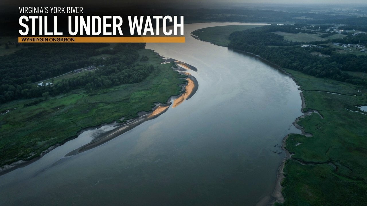
- The remaining river threat guidance named the Pamlico and Pungo Rivers, the Neuse and Bay Rivers, and the York River. A separate marine continuation retained residual North Carolina waters. The evening concern had become much more geographically limited.
- Local watch notifications control official clearances. The broader threat guidance helps describe where the danger continues, but dropping a county from that guidance alone doesn't serve as its official cancellation notice. Residents need the current local alert for their location.
- The watch classifies tornadoes as possible and tells people to monitor conditions. Its severity field says extreme. That describes the alert's hazard category. It doesn't measure the strength of an observed tornado or mean a tornado has touched down.
- A warning calls for protective action because the event is imminent or occurring nearby. Under a watch, conditions favor the hazard and people should prepare for warnings. That preparation gives households time to get ready before they need to act quickly.
- People in covered areas should review and discuss emergency plans, check supplies and safe-room arrangements, and follow changing weather alerts. Be ready to act quickly if a warning arrives or a tornado appears to be approaching.
- Officials hadn't confirmed a tornado within this watch's area and active period by early evening. Warnings and preliminary observations can come before later confirmation. Later observations or surveys could still identify a tornado or damage within this footprint.
- As of 6:12 p.m. Eastern, the watch hadn't been extended or completely canceled. The four Virginia counties and Emporia remained in the land continuation, with limited river areas in the threat guidance. Its scheduled eight o'clock expiration would end the watch period, without certifying that every weather hazard had ended.
情報源
223 件の情報源90 社のメディア
National Weather Serviceweather.gov38
- 最初の報道
- Tornado Watch issued October 11 at 1:56PM EDT until October 11 at 8:00PM EDT by NWS Wakefield VA
- Tornado Watch issued October 11 at 1:56PM EDT until October 11 at 8:00PM EDT by NWS Wakefield VA
- Wakefield, VA
- National Weather Service
- WARNING/ADVISORY CRITERIA
- Frequently Asked Questions (FAQ)
- WWA Summary for All Issued by RAH
- www.weather.gov
- WWA Summary for Tornado Watch
- National Weather Service
- WWA Summary by Location for 36.97N 76.3W with ANZ638/ANC638/ANZ638 emphasis Heavy Freezing Spray Warning
- WWA Summary for Tornado Watch Issued by LWX
- WWA Summary for Tornado Watch Issued by RAH
- National Weather Service
- National Weather Service
- National Weather Service
- National Weather Service
- WWA Summary by Location for 37.04N 76.15W with ANZ632/ANC632/ANZ632 emphasis Tornado Watch
- WWA Summary for All Issued by AKQ
- National Weather Service
- WWA Summary for All Issued by RAH
- National Weather Service
- WWA Summary for Tornado Watch Issued by CHS
- National Weather Service
- National Weather Service
- National Weather Service
- National Weather Service
- www.weather.gov
- Decision Support Weather Briefing
- Convective Watch Job Sheets
- Understand Tornado Alerts
- NWS Products and Criteria
- Watch/Warning/Advisory Definitions
- WARNING/ADVISORY CRITERIA
- Severe Weather Preparedness
- WWA Summary for All Issued by MHX
- National Weather Service
- Watches, Warnings & Advisories
GOES Image Viewer - NOAA/NESDIS/STAR websitenoaa.gov36
- 最初の報道
- tgftp.nws.noaa.gov
- Storm Prediction Center Tornado Watch 681
- tgftp.nws.noaa.gov
- Initial List of Counties in SPC Tornado Watch 681 (WOU)
- Storm Prediction Center - Current Convective Watches
- Storm Prediction Center Oct 11, 2026 2000 UTC Day 1 Convective Outlook
- www.spc.noaa.gov
- Storm Prediction Center Tornado Watch 681 Status Reports
- Storm Prediction Center Severe Thunderstorm Watch 681 Status Reports
- Storm Prediction Center Tornado Watch 681
- Storm Prediction Center Severe Thunderstorm Watch 681 Status Reports
- Storm Prediction Center Severe Thunderstorm Watch 681 Status Reports
- Storm Prediction Center Severe Thunderstorm Watch 681
- Storm Prediction Center Tornado Watch 681 Status Reports
- Storm Prediction Center Severe Thunderstorm Watch 681 Status Reports
- Storm Prediction Center Tornado Watch 681 Status Reports
- Storm Prediction Center Tornado Watch 681 Status Reports
- tgftp.nws.noaa.gov
- READY -
- tgftp.nws.noaa.gov
- Storm Prediction Center Severe Thunderstorm Watch 681 Status Reports
- Storm Prediction Center Severe Thunderstorm Watch 681 Status Reports
- Initial List of Counties in SPC Severe Thunderstorm Watch 681 (WOU)
- Initial List of Counties in SPC Tornado Watch 680 (WOU)
- Storm Prediction Center Severe Thunderstorm Watch 81 Status Reports
- Storm Prediction Center Severe Thunderstorm Watch 106 Status Reports
- Storm Prediction Center Mesoscale Discussion 881
- Atlantic Tropical Weather Discussion
- Post-Tropical Cyclone Isaias Public Advisory
- NOAA STAR Integrated Calibration/Validation System (ICVS) - Instrument Status - NPP OMPS NM
- All media advisories | National Oceanic and Atmospheric Administration
- WPC 6-Hour Probability of Precipitation Guidance for Days 1-3
- Day 3-7 U.S. Hazards Outlook
- www.ndbc.noaa.gov
- WPC Medium Range Archive
- West Coast Regional Office | NOAA Fisheries
Iowa Environmental Mesonetiastate.edu17
- mesonet.agron.iastate.edu
- IEM :: SPC Watches Listing
- IEM :: WCN from NWS MPX
- NWS Watches Warnings Advisories Download - IEM
- IEM :: WCN from NWS OTX
- IEM :: TAF from NWS AKQ
- mesonet.agron.iastate.edu
- IEM :: OK_DCP Network Summary for 11 Oct 2026
- IEM :: CA_QC_ASOS Network Summary for 11 Oct 2026
- www.mesonet.agron.iastate.edu
- IEM :: SYN from NWS BOU
- mesonet.agron.iastate.edu
- IEM :: CLI from NWS LOT
- www.mesonet.agron.iastate.edu
- www.mesonet.agron.iastate.edu
- IEM :: ZFP from NWS GLD
- VTEC Event 2026-O-NEW-KLWX-SC-Y-0006
X (formerly Twitter)x.com12
- 最初の報道
- 12:58pm CDT #SPC_Watch WW 681 TORNADO NC VA CW 111755Z - 120000Z, #ncwx #vawx #cwwx, https://www.spc.noaa.gov/products/watch/ww0681.html
- Tornado Warning including Quarryville PA, Delta PA and Wakefield PA until 9:45 PM EDT https://twitter.com/NWStornado/status/2066323195360117002/photo/1
- A tornado watch has been issued for parts of North Carolina, South Carolina and Virginia until 6 PM EDT
- #SPC issues Day 1 Slight Convective Risk at Oct 11, 16:29z for LWX https://www.spc.noaa.gov/products/outlook/archive/2026/day1otlk_20261011_1630.html
- 44
- RT @Notasaint99: That one message is community note alert
- 96
- Wake County school board work session to discuss policy changes requiring principals to allow all education employee associations like NCAE onto schools & review student due process appeal process. Agenda at https://simbli.eboardsolutions.com/SB_Meetings/ViewMeeting.aspx?S=920&MID=19146 Watch at https://www.youtube.com/watch?v=3uly83Unj1Q #wcpss
- 🟇 #NATO Multinational Multi-Role Tanker Transport Fleet (9); 2026-10-06Z ➢ 7 (78%) of the fleet has flown in the past 28 days. Eindhoven Air Base (EHEH) 🇳🇱 (2) ➢ T-055 #480C41 (18d) ➢ T-061 #480C47 Cologne Bonn Airport (EDDK) 🇩🇪 (3) ➢ T-058 #480C44 (13d) ➢ T-060 #480C46 (13d) ➢ T-056 #480C42 (2d) Orland (ENOL) 🇳🇴 (2) ➢ T-059 #480C45 ➢ T-062 #480C48
- Although it's hard to know what's real in a disinformation-rich environment like Ethiopia, it's definitely true that lots of money is spent on weapons by people who frankly have better things to do with it.
- AKQ issues Coastal Flood Statement valid at Oct 11, 7:00 AM EDT for Accomack, Northampton [VA] till Oct 11, 3:00 PM EDT https://mesonet.agron.iastate.edu/vtec/f/2026-O-NEW-KAKQ-CF-S-0015_2026-10-11T11:00Z
- Direct link to the data. https://ndawn.info/currentwx/watkins A reminder that those current pages will have a major update coming soon, hopefully sometime in November.
FlightAwareflightaware.com4
grail-watch.com3
capeweather.com2
【公式】スカパー!スポーツ、音楽、アニメ、 映画をTVでもスマホでも視聴可skyperfectv.co.jp1
aboutnumber.ru1
af.mil1
Alaska Airlinesalaskaair.com1
Apple Podcastsapple.com1
armywarcollege.edu1
BQ Watchesbqwatches.com1
Business Quantbusinessquant.com1
calaverasenterprise.com1
celestrak.org1
ChartExchangechartexchange.com1
chicagoweatherstation.com1
Chronoscoutchronoscout.co1
CommandEleven Intelligencecommandeleven.com1
Diyanet İşleri Başkanlığıdiyanet.gov.tr1
fairfaxcounty.gov1
Flight Statusflight-status.com1
GOV.WALESgov.wales1
hollandwatchgroup.com1
HowLongAgoGohowlongagogo.com1
https://www.wect.comwect.com1
https://www.witn.comwitn.com1
https://www.wmbfnews.comwmbfnews.com1
javsubtitled.com1
KeepTrackkeeptrack.space1
learnmeabitcoin.com1
ligaram.me1
LiveAuctioneersliveauctioneers.com1
MarketBeatmarketbeat.com1
MarketScreenermarketscreener.com1
militaryfactory.com1
minorplanetcenter.net1
nextearningsdate.com1
petersburgva.gov1
PlaneMapperplanemapper.com1
Prayer Timespray-times.com1
rozklad-pkp.pl1
s3.us-west-1.amazonaws.com1未確認のサイト
sotwesotwe.com1
stockwatch.com1
The Area Codescodigosinternacionales.com1
The Watch Sitethewatchsite.com1最初
trac.jobs1
Traveling Lifestyletravelinglifestyle.net1
TU Newstradersunion.com1
TV Passporttvpassport.com1
Tygart Mediatygartmedia.com1
umd.edu1
upstatetoday.com1
USA 681 🛰 - Satellite information • ISS Trackerisstracker.pl1
Weichertweichert.com1
whatcomcounty.us1
wikipedia.org1
worldcubeassociation.org1
WSAV-TVwsav.com1

情報源マップ
この報道の根拠をたどります。マップで情報のつながりを確認し、下のリンクから記事で引用された情報源を開けます。
記事を読む間に情報源マップを読み込みます。
翻訳更新:
改訂履歴
- r1初公開。