灾害 · 龙卷风监视
龙卷风监视令 681 范围缩小至弗吉尼亚州四个县和恩波里亚
截至 10 月 11 日美国东部夏令时间下午 6:12,弗吉尼亚州的四个县和恩波里亚仍在陆地区域延续通知范围内。有限的河流水域威胁仍然存在,计划于晚上 8 点到期——这并不代表一切安全。
原语言视频
文字实录 · 正在加载
译自英文原文。
新闻追踪第 6 天
1 篇报道90 家媒体223 个来源

龙卷风监视范围缩小时,还有哪些情况需要关注?对于龙卷风监视令 681,傍晚时分的答案是弗吉尼亚州四个县、独立市恩波里亚,以及一份短得多的水域清单,而不是警报刚发布时所列的广阔沿海范围。
截至 2026 年 10 月 11 日美国东部夏令时间下午 6:12,监视令仍计划于晚上 8 点结束。尚未确认会延长或完全取消。韦克菲尔德下午晚些时候发布的陆地区域延续通知涵盖布伦瑞克县、丁威迪县、格林斯维尔县和梅克伦堡县,以及恩波里亚市。龙卷风仍有可能发生;监视令本身并不能证明已经发生龙卷风。17 28
对于将下午警报与晚间计划进行比对的人来说,关键区别在于:最初的覆盖范围告诉你监视令从哪里开始,并不一定代表它后来仍覆盖哪些地方。范围缩小后的监视令,对仍在覆盖范围内的人依然是准备警报;计划到期时间也不保证所有天气危险届时都会结束。
傍晚时分威胁仍然存在的区域
国家气象局韦克菲尔德办公室于美国东部夏令时间下午 4:51 发布延续通知,称监视令 681“仍然有效,直至今晚美国东部夏令时间晚上 8 点”。通知将剩余陆地区域列为“5 个县”,但点名的辖区实际包括四个县和一个独立市。恩波里亚应计入辖区总数,而非县的数量。17
切斯城、克拉克斯维尔、劳伦斯维尔和南希尔是该延续区域内列出的社区之一。这些地名有助于居民确认自己所在的位置,但不会增加监视令涉及的县级辖区数量。17
监视令 681 的范围如何缩小
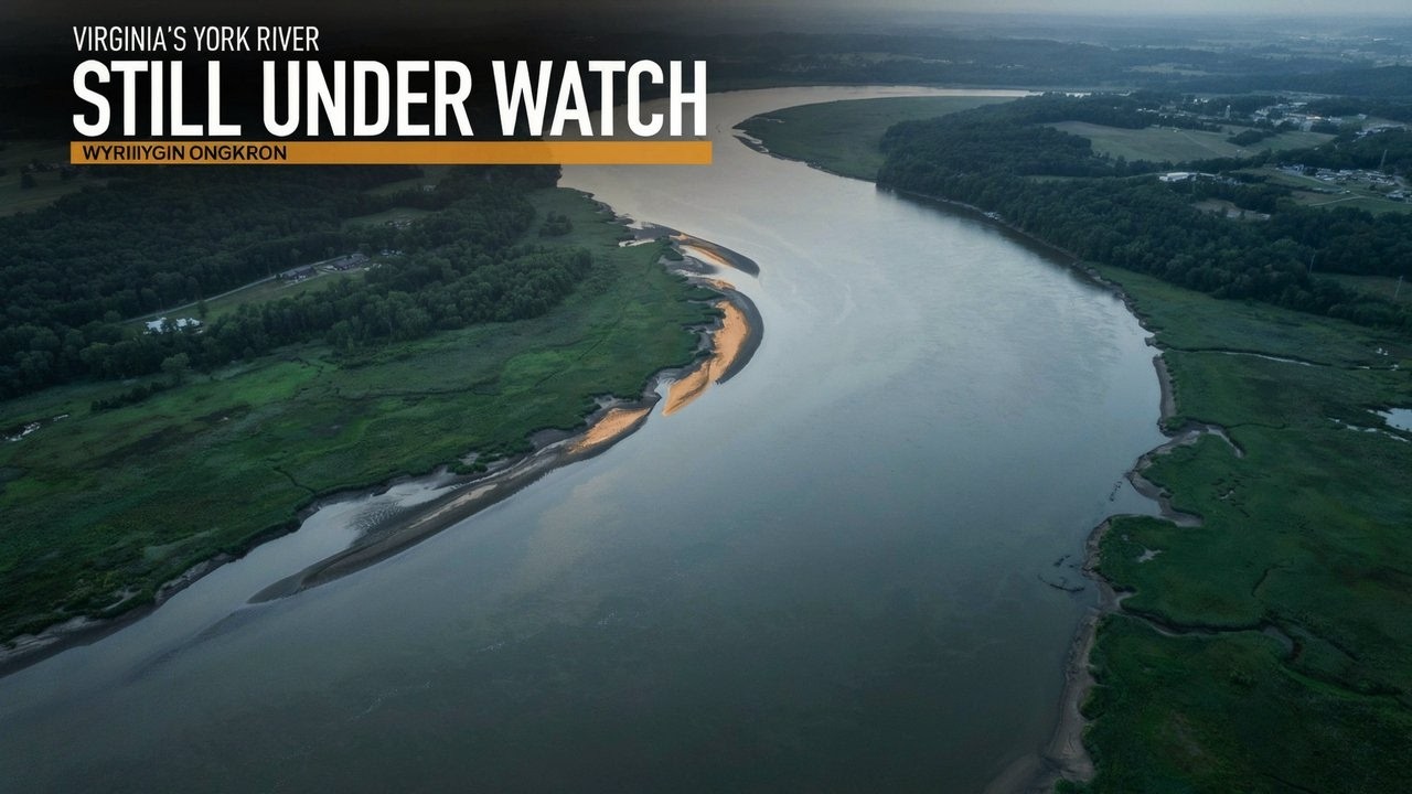
风暴预报中心第二份状态报告的有效时段为美国东部夏令时间下午 5:50 至 6:40,其中指出持续存在海上威胁的区域为帕姆利科河和庞戈河、纽斯河和贝伊河,以及约克河。这些区域的代码为 AMZ136、AMZ137 和 ANZ636。另一份海上延续通知保留了北卡罗来纳州剩余水域。58 17
较早发布、有效时段为下午 5:45 至 6:40 的一份状态报告,仍列有北卡罗来纳州昂斯洛县,以及弗吉尼亚州的 5 个辖区和更长的海上区域清单,其中包括俄勒冈湾至卢考特角之间的沿海区段。下一份报告给出了范围更窄的图景。58
但这项变化能说明的内容有限。风暴预报中心明确将其状态信息标注为指引,并提醒读者查阅当地的监视令辖县通知,了解哪些县、独立市和海上区域已解除监视。仅仅因为某县没有出现在指引中,并不代表其已收到正式解除通知。弗吉尼亚州陆地区域延续通知明确列出了具体范围;其他地方的居民应查看当前当地警报,而不能把状态报告当作替代信息。58
最初的清单为何看起来不同
监视令 681 于美国东部夏令时间下午 1:55 由风暴预报中心发布;韦克菲尔德当地通知一分钟后跟进。这两个相邻的时间戳指的是同一项监视令,并非两条相互竞争的警报。两者列出的计划结束时间相同:10 月 11 日美国东部夏令时间晚上 8 点,相当于 10 月 12 日 UTC 午夜。14 1 2
最初关于弗吉尼亚州的表述还需要修正计数。所谓“26 个县”,实际是26 个辖区:12 个县和 14 个独立市。这些县是布伦瑞克县、查尔斯城县、丁威迪县、格林斯维尔县、艾尔岛县、詹姆斯城县、梅克伦堡县、乔治王子县、南安普敦县、萨里县、萨塞克斯县和约克县。2 25
独立市包括切萨皮克、科洛尼尔海茨、恩波里亚、富兰克林、汉普顿、霍普韦尔、纽波特纽斯、诺福克、彼得斯堡、波阔森、朴次茅斯、萨福克、弗吉尼亚海滩和威廉斯堡。它们已计入 26 个辖区之中,并非在此基础上还要再加 14 个地方。这份最初的清单记录的是下午发布时的历史覆盖范围,而非傍晚的陆地区域延续范围。25
北卡罗来纳州最初的两个数字同样指不同的地理范围。韦克菲尔德辖区覆盖 9 个县:伯蒂县、卡姆登县、乔万县、柯里塔克县、盖茨县、赫特福德县、北安普顿县、帕斯阔坦克县和佩尔奎曼斯县。风暴预报中心的完整范围还包括这 9 个县,以及博福特县、卡特雷特县、克雷文县、戴尔县、海德县、琼斯县、马丁县、昂斯洛县、帕姆利科县、泰勒尔县和华盛顿县,北卡罗来纳州合计 20 个县。9 个与 20 个的差异是办公辖区覆盖范围不同,并非对同一份清单意见不一。2 25
最初的海上通知同样列明了精确范围。范围包括切萨皮克湾从新普莱森特角至小溪、以及从小溪至亨利角的水域,包括切萨皮克湾跨海大桥隧道;柯里塔克湾;以及约克河。詹姆斯河覆盖范围从詹姆斯敦至詹姆斯河大桥,再从该桥至汉普顿路桥隧道,并包括伊丽莎白河。近海范围从查尔斯角灯塔至弗吉尼亚州与北卡罗来纳州边界,并继续延伸至柯里塔克海滩灯塔;每个区段向外延伸 20 海里。1
这些是边界,并非观测结果。列出一条河或一个海湾,并不意味着那里曾观测到龙卷风或水龙卷。“向外延伸 20 海里”界定的是沿海监视区域,并非建议与风暴保持的距离。
现在做好准备,收到警报后采取行动
监视令表示天气条件有利于危险天气发生,人们应为收到警报做好准备。警报则表示天气事件即将发生或正在附近发生,需要采取防护行动。韦克菲尔德官方标准明确提出:“采取行动,保护生命和财产。”11
对于处于覆盖区域的人,国家气象局建议查看并讨论应急计划、盘点物资、检查安全房间的安排,并在发布警报或有龙卷风逼近迹象时做好迅速行动的准备。保持关注是一项主动任务,不应成为推迟准备、等到警报发布后才行动的理由。使用水域的人也需要关注所在具体海上区域的警报,而不能只根据县名判断。134 1
最初警报的元数据使用了三种不同分类:龙卷风发生可能性为“可能”,严重程度为“极端”,建议应对方式为“监测”。它们回答的是不同问题。“极端”不会把可能发生的龙卷风变成已确认发生的龙卷风,也不代表已观测到的龙卷风强度。2
截至美国东部夏令时间下午 6:12,在所审查材料中,没有官方确认的龙卷风被认定发生在监视令 681 自身的范围和有效时段内。这并不能证明没有龙卷风发生。警报、初步观测和完成确认是证据形成的不同阶段,而且监视令当时仍处于计划有效期内。33 61
因此,接下来要分别核实两件事:监视令是否按计划结束或再次发生变化,以及后续观测或调查是否确认其覆盖范围内发生龙卷风或出现损害。对于傍晚时分查看信息的人,眼下的指示更简单:查看更新后的地理范围;如果仍在覆盖范围内,就做好准备;不要把范围缩小或即将到期误认为一切安全。
播出原貌 22 行
- Forecasters narrowed Virginia's tornado watch from 26 land jurisdictions to five.
- Tornadoes remain possible for people in the remaining land areas and along several rivers. The watch is scheduled to end at eight tonight, but that deadline doesn't promise an end to every weather hazard.
- Which land areas and waterways still face the threat as the watch approaches its scheduled end?
- Brunswick, Dinwiddie, Greensville and Mecklenburg counties remain covered, along with the independent city of Emporia. Forecasters kept those five jurisdictions under Tornado Watch 681 in the late-afternoon continuation. The much larger original footprint had already narrowed.
- Emporia counts as an independent city. The continuation called its list five counties, but it named four counties and Emporia. Virginia's independent cities are separate jurisdictions, so that shorthand can make the county count sound larger than it is.
- Chase City, Clarksville, Lawrenceville and South Hill are among the communities named within that continuing land area. Those community names help residents locate themselves within the watch. They don't add more counties to its coverage.
- The original Virginia notice covered 26 jurisdictions. The later continuation kept five land areas covered, with the scheduled end still eight tonight. That reduction changes who needs to prepare, even while the remaining communities continue facing a possible tornado threat.
- The Storm Prediction Center began Watch 681 at 1:55 in the afternoon on October 11. Wakefield issued its local land and marine notices one minute later. Both set the same evening expiration.
- The initial notice also called Virginia's coverage 26 counties. Its complete list contained 12 counties and 14 independent cities, making 26 jurisdictions altogether. That earlier footprint stretched across south-central and southeastern Virginia, including Hampton Roads cities that aren't in the later five-area land continuation.
- Wakefield's initial North Carolina notice covered nine counties. The full interstate watch covered 20 North Carolina counties, including those nine. Different weather offices handled different portions of the same watch, so the larger total describes a wider geographic area.
- The Chesapeake Bay Bridge-Tunnel was inside the original marine footprint. That coverage ran from New Point Comfort to Little Creek, then from Little Creek to Cape Henry. These were specific stretches of the bay where people needed to prepare for possible tornadoes.
- Currituck Sound and the York River were also included. The James River coverage ran from Jamestown to the James River Bridge, then onward to the Hampton Roads Bridge-Tunnel. That second stretch included the Elizabeth River.
- The original coastal coverage extended 20 nautical miles offshore. It ran from Cape Charles Light to the Virginia–North Carolina border, and from there to Currituck Beach Light. The broader watch also included the Alligator River, Pamlico Sound, and Albemarle, Croatan and Roanoke sounds.
- For people using those waters, the alert geography follows named water zones as well as land boundaries. The offshore distance defines the covered area. Boaters still need to follow the changing alerts for their particular waterway.
- Onslow County remained in the earlier evening threat guidance, alongside the five Virginia jurisdictions and a longer marine list. The next guidance omitted North Carolina land counties and reduced the marine list. Both guidance periods ran through 6:40 in the evening.
- The remaining river threat guidance named the Pamlico and Pungo Rivers, the Neuse and Bay Rivers, and the York River. A separate marine continuation retained residual North Carolina waters. The evening concern had become much more geographically limited.
- Local watch notifications control official clearances. The broader threat guidance helps describe where the danger continues, but dropping a county from that guidance alone doesn't serve as its official cancellation notice. Residents need the current local alert for their location.
- The watch classifies tornadoes as possible and tells people to monitor conditions. Its severity field says extreme. That describes the alert's hazard category. It doesn't measure the strength of an observed tornado or mean a tornado has touched down.
- A warning calls for protective action because the event is imminent or occurring nearby. Under a watch, conditions favor the hazard and people should prepare for warnings. That preparation gives households time to get ready before they need to act quickly.
- People in covered areas should review and discuss emergency plans, check supplies and safe-room arrangements, and follow changing weather alerts. Be ready to act quickly if a warning arrives or a tornado appears to be approaching.
- Officials hadn't confirmed a tornado within this watch's area and active period by early evening. Warnings and preliminary observations can come before later confirmation. Later observations or surveys could still identify a tornado or damage within this footprint.
- As of 6:12 p.m. Eastern, the watch hadn't been extended or completely canceled. The four Virginia counties and Emporia remained in the land continuation, with limited river areas in the threat guidance. Its scheduled eight o'clock expiration would end the watch period, without certifying that every weather hazard had ended.
来源
223 个来源90 家媒体
National Weather Serviceweather.gov38
- 首次报道于
- Tornado Watch issued October 11 at 1:56PM EDT until October 11 at 8:00PM EDT by NWS Wakefield VA
- Tornado Watch issued October 11 at 1:56PM EDT until October 11 at 8:00PM EDT by NWS Wakefield VA
- Wakefield, VA
- National Weather Service
- WARNING/ADVISORY CRITERIA
- Frequently Asked Questions (FAQ)
- WWA Summary for All Issued by RAH
- www.weather.gov
- WWA Summary for Tornado Watch
- National Weather Service
- WWA Summary by Location for 36.97N 76.3W with ANZ638/ANC638/ANZ638 emphasis Heavy Freezing Spray Warning
- WWA Summary for Tornado Watch Issued by LWX
- WWA Summary for Tornado Watch Issued by RAH
- National Weather Service
- National Weather Service
- National Weather Service
- National Weather Service
- WWA Summary by Location for 37.04N 76.15W with ANZ632/ANC632/ANZ632 emphasis Tornado Watch
- WWA Summary for All Issued by AKQ
- National Weather Service
- WWA Summary for All Issued by RAH
- National Weather Service
- WWA Summary for Tornado Watch Issued by CHS
- National Weather Service
- National Weather Service
- National Weather Service
- National Weather Service
- www.weather.gov
- Decision Support Weather Briefing
- Convective Watch Job Sheets
- Understand Tornado Alerts
- NWS Products and Criteria
- Watch/Warning/Advisory Definitions
- WARNING/ADVISORY CRITERIA
- Severe Weather Preparedness
- WWA Summary for All Issued by MHX
- National Weather Service
- Watches, Warnings & Advisories
GOES Image Viewer - NOAA/NESDIS/STAR websitenoaa.gov36
- 首次报道于
- tgftp.nws.noaa.gov
- Storm Prediction Center Tornado Watch 681
- tgftp.nws.noaa.gov
- Initial List of Counties in SPC Tornado Watch 681 (WOU)
- Storm Prediction Center - Current Convective Watches
- Storm Prediction Center Oct 11, 2026 2000 UTC Day 1 Convective Outlook
- www.spc.noaa.gov
- Storm Prediction Center Tornado Watch 681 Status Reports
- Storm Prediction Center Severe Thunderstorm Watch 681 Status Reports
- Storm Prediction Center Tornado Watch 681
- Storm Prediction Center Severe Thunderstorm Watch 681 Status Reports
- Storm Prediction Center Severe Thunderstorm Watch 681 Status Reports
- Storm Prediction Center Severe Thunderstorm Watch 681
- Storm Prediction Center Tornado Watch 681 Status Reports
- Storm Prediction Center Severe Thunderstorm Watch 681 Status Reports
- Storm Prediction Center Tornado Watch 681 Status Reports
- Storm Prediction Center Tornado Watch 681 Status Reports
- tgftp.nws.noaa.gov
- READY -
- tgftp.nws.noaa.gov
- Storm Prediction Center Severe Thunderstorm Watch 681 Status Reports
- Storm Prediction Center Severe Thunderstorm Watch 681 Status Reports
- Initial List of Counties in SPC Severe Thunderstorm Watch 681 (WOU)
- Initial List of Counties in SPC Tornado Watch 680 (WOU)
- Storm Prediction Center Severe Thunderstorm Watch 81 Status Reports
- Storm Prediction Center Severe Thunderstorm Watch 106 Status Reports
- Storm Prediction Center Mesoscale Discussion 881
- Atlantic Tropical Weather Discussion
- Post-Tropical Cyclone Isaias Public Advisory
- NOAA STAR Integrated Calibration/Validation System (ICVS) - Instrument Status - NPP OMPS NM
- All media advisories | National Oceanic and Atmospheric Administration
- WPC 6-Hour Probability of Precipitation Guidance for Days 1-3
- Day 3-7 U.S. Hazards Outlook
- www.ndbc.noaa.gov
- WPC Medium Range Archive
- West Coast Regional Office | NOAA Fisheries
Iowa Environmental Mesonetiastate.edu17
- mesonet.agron.iastate.edu
- IEM :: SPC Watches Listing
- IEM :: WCN from NWS MPX
- NWS Watches Warnings Advisories Download - IEM
- IEM :: WCN from NWS OTX
- IEM :: TAF from NWS AKQ
- mesonet.agron.iastate.edu
- IEM :: OK_DCP Network Summary for 11 Oct 2026
- IEM :: CA_QC_ASOS Network Summary for 11 Oct 2026
- www.mesonet.agron.iastate.edu
- IEM :: SYN from NWS BOU
- mesonet.agron.iastate.edu
- IEM :: CLI from NWS LOT
- www.mesonet.agron.iastate.edu
- www.mesonet.agron.iastate.edu
- IEM :: ZFP from NWS GLD
- VTEC Event 2026-O-NEW-KLWX-SC-Y-0006
X (formerly Twitter)x.com12
- 首次报道于
- 12:58pm CDT #SPC_Watch WW 681 TORNADO NC VA CW 111755Z - 120000Z, #ncwx #vawx #cwwx, https://www.spc.noaa.gov/products/watch/ww0681.html
- Tornado Warning including Quarryville PA, Delta PA and Wakefield PA until 9:45 PM EDT https://twitter.com/NWStornado/status/2066323195360117002/photo/1
- A tornado watch has been issued for parts of North Carolina, South Carolina and Virginia until 6 PM EDT
- #SPC issues Day 1 Slight Convective Risk at Oct 11, 16:29z for LWX https://www.spc.noaa.gov/products/outlook/archive/2026/day1otlk_20261011_1630.html
- 44
- RT @Notasaint99: That one message is community note alert
- 96
- Wake County school board work session to discuss policy changes requiring principals to allow all education employee associations like NCAE onto schools & review student due process appeal process. Agenda at https://simbli.eboardsolutions.com/SB_Meetings/ViewMeeting.aspx?S=920&MID=19146 Watch at https://www.youtube.com/watch?v=3uly83Unj1Q #wcpss
- 🟇 #NATO Multinational Multi-Role Tanker Transport Fleet (9); 2026-10-06Z ➢ 7 (78%) of the fleet has flown in the past 28 days. Eindhoven Air Base (EHEH) 🇳🇱 (2) ➢ T-055 #480C41 (18d) ➢ T-061 #480C47 Cologne Bonn Airport (EDDK) 🇩🇪 (3) ➢ T-058 #480C44 (13d) ➢ T-060 #480C46 (13d) ➢ T-056 #480C42 (2d) Orland (ENOL) 🇳🇴 (2) ➢ T-059 #480C45 ➢ T-062 #480C48
- Although it's hard to know what's real in a disinformation-rich environment like Ethiopia, it's definitely true that lots of money is spent on weapons by people who frankly have better things to do with it.
- AKQ issues Coastal Flood Statement valid at Oct 11, 7:00 AM EDT for Accomack, Northampton [VA] till Oct 11, 3:00 PM EDT https://mesonet.agron.iastate.edu/vtec/f/2026-O-NEW-KAKQ-CF-S-0015_2026-10-11T11:00Z
- Direct link to the data. https://ndawn.info/currentwx/watkins A reminder that those current pages will have a major update coming soon, hopefully sometime in November.
FlightAwareflightaware.com4
grail-watch.com3
capeweather.com2
【公式】スカパー!スポーツ、音楽、アニメ、 映画をTVでもスマホでも視聴可skyperfectv.co.jp1
aboutnumber.ru1
af.mil1
Alaska Airlinesalaskaair.com1
Apple Podcastsapple.com1
armywarcollege.edu1
BQ Watchesbqwatches.com1
Business Quantbusinessquant.com1
calaverasenterprise.com1
celestrak.org1
ChartExchangechartexchange.com1
chicagoweatherstation.com1
Chronoscoutchronoscout.co1
CommandEleven Intelligencecommandeleven.com1
Diyanet İşleri Başkanlığıdiyanet.gov.tr1
fairfaxcounty.gov1
Flight Statusflight-status.com1
GOV.WALESgov.wales1
hollandwatchgroup.com1
HowLongAgoGohowlongagogo.com1
https://www.wect.comwect.com1
https://www.witn.comwitn.com1
https://www.wmbfnews.comwmbfnews.com1
javsubtitled.com1
KeepTrackkeeptrack.space1
learnmeabitcoin.com1
ligaram.me1
LiveAuctioneersliveauctioneers.com1
MarketBeatmarketbeat.com1
MarketScreenermarketscreener.com1
militaryfactory.com1
minorplanetcenter.net1
nextearningsdate.com1
petersburgva.gov1
PlaneMapperplanemapper.com1
Prayer Timespray-times.com1
rozklad-pkp.pl1
s3.us-west-1.amazonaws.com1未经核实的网站
sotwesotwe.com1
stockwatch.com1
The Area Codescodigosinternacionales.com1
The Watch Sitethewatchsite.com1最先
trac.jobs1
Traveling Lifestyletravelinglifestyle.net1
TU Newstradersunion.com1
TV Passporttvpassport.com1
Tygart Mediatygartmedia.com1
umd.edu1
upstatetoday.com1
USA 681 🛰 - Satellite information • ISS Trackerisstracker.pl1
Weichertweichert.com1
whatcomcounty.us1
wikipedia.org1
worldcubeassociation.org1
WSAV-TVwsav.com1

来源地图
追溯本篇报道的依据。图谱展示其关联;下方链接可打开本文引用的来源。
来源图谱将在您阅读时加载。
译文更新于
修订记录
- r1首次发布。