灾害 · 巴拿马地震持续报道 · 第 2 篇,共 2 篇
巴拿马地震的海啸威胁解除。受损学校和强烈余震仍令人担忧。
初步评估报告至少27人受轻伤,400多处建筑受到影响。沿海威胁已经结束,但建筑安全问题仍未解决。
原语言视频
文字实录 · 正在加载
译自英文原文。
持续报道第 3 天
2 篇报道186 家媒体330 个来源1 个视频
完整报道

自上次报道以来的变化
一小时内
当时
巴拿马7.7级地震造成数百栋建筑受损,尚无确认死亡人员当时尚无定论
- 完整的结构损坏程度清单、持续更新的避难人数,以及经核实的全国维修费用总额,均尚未确定。
我们说过将关注的
- 随着余震持续,后续检查和民防部门的评估必须明确,哪些受影响建筑可以继续使用。
现在
初步评估报告至少27人受轻伤,400多处建筑受到影响。沿海威胁已经结束,但建筑安全问题仍未解决。
现已确认
- 初步伤情和大范围基础设施受损已有记录,最初的国际海啸威胁也已结束。
截至2026年10月10日上午,初步应急评估记录显示,至少27人受轻伤,9个省有400多处建筑受到影响。没有报告死亡或失踪。这是一份令人鼓舞的初步情况报告,并非最终伤亡统计。最初发布的太平洋海啸威胁已经解除;地震应急状态尚未结束。58 60 15 34
关键事实
10月9日巴拿马时间下午12:56:06,也就是17:56:06 UTC,发生了7.7级地震。震中位于埃雷拉省阿苏埃罗半岛的皮塔洛萨阿里巴以西偏南12公里处,首选震源深度为12.6公里。这两个距离描述的是不同事物:一个表示震中相对于某个聚居地的位置,另一个表示地震震源位于地表以下的深度。21 22
早期震级估算包括8.0级,太平洋海啸公告使用了7.6级,巴拿马方面的估算则包括约7.2级以及之后的7.5级。它们都是对同一次主震的估算,并非不同的主震。经审核后采用的美国地质调查局首选震级仍为7.7级。欧洲另一家机构的独立测算给出的震源深度为10公里,而非美国地质调查局的数值。21 10 14 60
损害范围超出最初画面所示
初步清单列出142栋房屋、188处教育设施、20处医疗设施、26栋政府建筑、13座教堂、7家酒店和9座桥梁受到影响。部分道路和供水处理设施也遭到损坏。这些类别并非最终且不重复计算的损毁总数。“受到影响”不等于被毁,医疗设施这一数字也不能证明20家医院已经停止运营。60
损害集中在巴拿马中部和阿苏埃罗地区,包括埃雷拉、洛斯桑托斯、贝拉瓜斯和科克莱。在佩诺诺梅,多斯孔蒂嫩特斯酒店外墙、圣胡安包蒂斯塔大教堂钟楼和省政府大楼遭到损坏或部分坍塌。报告还指出奇特雷、拉斯塔布拉斯和圣地亚哥周边受到影响。托诺西和坎布塔尔周边道路中断,托诺西周边地区据报与外界隔绝。54 64 68
最初的印象必然较为有限。CNN摄影记者卡洛斯·马蒂内利描述说,他的汽车剧烈地左右摇晃,人们则从建筑中跑出。他认为巴拿马城可见损害相对较少,这只是目击者的观察,并非对首都的结构安全评估,也不是全国调查。之后的应急清单呈现了范围广得多的情况。2 58
随着报告陆续抵达,伤者人数也逐渐更新。法新社在10月10日的一份早期报道中称至少有2人受伤;《Infobae》此前的一篇报道则指出,科克莱有15名学生受轻伤。之后的应急统计将总数列为27人。这些时间先后不同、统计范围也不同的报告不应相加。后续统计所依据的现场评估具体时间,无法从其发布时间戳中确定。4 40 58
有6个省报告停电,供水处理设施则遭到损坏或运行能力低于正常水平。目前尚无可靠的全国性恢复时间表。托库门国际机场一度暂停运营,并疏散乘客和工作人员,之后在检查继续进行期间恢复航班。巴拿马运河运营正常,Cobre Panamá矿场也据报运行正常。主要设施继续运行,并不意味着受损的房屋、学校或地方道路就是安全的。111 60 98 99 31
沿海预报已不再有效
10月9日18:51 UTC,太平洋海啸预警中心发布的第三份消息预测,巴拿马部分海岸可能出现高于潮位1至3米的海浪。这是对可能浪高的预测,并非对通常干燥地面上实测洪水高度的描述,也不代表已确认有3米高的海浪抵达。13 20 85
第四份公告明确标注为“PTWC最终海啸威胁消息”。公告正文时间为19:39 UTC,发送栏时间为19:40 UTC——同一份公告有两个时间戳。报道证实,与地震相关的海啸威胁当时已经结束;这早于此前预测海浪于20:41 UTC,也就是巴拿马当地下午3:41抵达巴尔博亚高地的时间。没有经核实的测量结果证明海浪在预测时间抵达那里。15 34 85
威胁解除,并不等于确认海面从未发生变化。据当地报道援引地球科学研究所和民防部门的说法,异常海浪进入了卡尼亚斯岛上一些靠近海岸的住宅。卡尼亚斯约有300名居民转移至地势较高处。另有8个家庭被安置到科克莱的临时避难所。这些是有依据的转移安置案例,并非全国完整的流离失所人数统计;沿海观察也无法证明发生了经测量确认的3米高海啸。205 206 60
太平洋海啸预警中心发布的信息为各国主管部门提供指导,各国自行决定是否发布警报及采取防护措施。包括墨西哥、哥伦比亚、哥斯达黎加、厄瓜多尔、萨尔瓦多、危地马拉、尼加拉瓜和秘鲁在内的国家启动了区域警报,随后予以取消,但并非所有取消时间都已确认。国际最终公告并不能证明各地的疏散指令都已解除。13 18 143
余震接连发生,给检查工作带来压力
震动接连迅速发生:18:22 UTC,巴霍科拉尔附近发生5.5级地震;随后,18:37 UTC,埃尔卡考附近发生5.8级地震。约20:25 UTC,也就是当地下午3:25,圣地亚哥地区的里奥格兰德附近发生更大的6.6级地震,最初估值为6.9级。之后还发生了包括拉特罗诺萨附近6.0级地震在内的震动。213 106 198 51 145
美国地质调查局于10月10日00:51 UTC发布的一周余震预测显示,截至10月17日01:00 UTC,发生至少一次6级或以上地震的概率为67 percent。发生7级或以上地震的概率为12 percent,发生不小于7.7级主震的地震概率为two percent,发生8级或以上地震的概率为one percent。这些是概率,并非对某次地震发生地点或时间的预测。23
对于5级或以上地震,预测给出的概率高于99 percent,最可能发生的次数为3至38次。下一次定期更新约在10月11日01:00 UTC发布。若没有统一的时间范围和震级门槛,就无法把当地报告的超过45次至147次的序列总数统一成一个精确数字。预测发布时,美国地质调查局目录中有22次3级或以上地震,其中包括11次5级或以上地震。23 54
震源机制已有部分明确:此次地震主要涉及横向的走滑运动。美国地质调查局的构造总结称其为左旋运动,但对技术模型中滑动方向的解读仍未统一。两种可能的断层走向无法唯一确定实际破裂面。目前尚未证实震源破裂发生在阿苏埃罗—索纳断层系统。21 26 29
风险模型不是损失账单
美国地质调查局的经济损失估算也已发生变化。最初的报告给出的范围为巴拿马国内生产总值的one至ten percent;后来查阅的一份较早产品给出的范围则为zero至nine percent。首选产品于10月9日约23:51 UTC更新,给出的范围为three至thirty percent,并保留红色经济损失警报。该较晚发布的损失模型产品被标注为未经科学家审核,这与经过审核的地震测量不同。这些范围都不是经审计的损失总额,也不能证明经济已遭受30 percent的损毁。1 27 176
对震动影响人口的估算也需要同样谨慎。约460万这一中度至强烈震动的概括估值,与后续表格中这些烈度类别合计约482.5万的数字不同。另有14,000人被模型估计暴露于剧烈震动。这些估算描述的是暴露情况,并非受伤人数、无家可归人数或一个精确的人口总数。21 176
总统何塞·劳尔·穆利诺宣布将立即开展结构安全评估,并向受影响民众提供支持;他还与部长蒙塔尔沃前往佩诺诺梅检查损害并协调援助。这些公告表明了行动意向和应对活动,并不能证明维修已经完成或每户家庭都已获得援助。民防部门建议居民避开受损建筑并遵守官方指示;该部门公布了911和应急行动中心电话号码520-4426。54 60 41
未知
- 目前尚无最终伤亡统计、完整损害清单、经核实的经济损失总额或全面的建筑安全情况说明。
后续
- 结构安全检查结果、疏散状态、基本服务恢复情况以及下一次余震预测,将决定恢复工作能否安全推进。
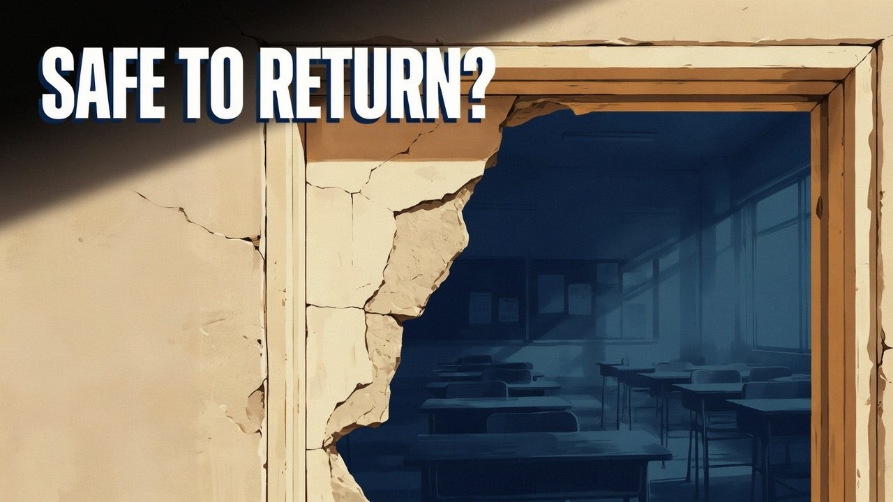
真正有意义的全面安全通告,必须逐栋建筑、逐条路线来确认。沿海威胁结束,只是消除了一种危险;它并未回答家庭是否能够回家、教室能否重新开放,或在下一次强烈余震之前救护车能否抵达受损社区。
播出原貌 33 行
- Panama’s magnitude 7.7 earthquake damaged more than 400 structures across nine provinces. The initial tsunami threat has ended, but further shaking threatens weakened homes, schools and healthcare facilities. The urgent question is which buildings and roads people can safely use while strong aftershocks remain possible.
- The earthquake struck 12 kilometers west-southwest of Pitaloza Arriba, on the Azuero Peninsula in Herrera Province. It began shortly before one in the afternoon on October 9. Its origin was shallow, at a depth of 12.6 kilometers.
- The reviewed magnitude remains 7.7. Early estimates ranged from 7.2 to 8.0, with a tsunami bulletin using 7.6 and a later national estimate giving 7.5. Those figures describe successive estimates of the same main earthquake. A separate European calculation gave a depth of 10 kilometers.
- Civil protection’s preliminary assessment puts the injury count at at least 27, all described as minor. Officials reported no deaths or missing people. That assessment was available by the morning of October 10, and the casualty count could still change.
- Earlier counts identified two injured people, then 15 students with minor injuries in Coclé. The later assessment brings the total to 27. The student count was a partial account and shouldn't be added to that total.
- Officials list 142 affected houses, 188 educational facilities and 20 healthcare facilities. School damage ranges from cracks to partial structural collapse. Each building needs its own assessment before families can know whether it's safe to return.
- Penonomé suffered damage to the Hotel Dos Continentes facade, the San Juan Bautista Cathedral tower and the provincial government building. Damage and partial collapses there give a concrete picture of the emergency beyond the early shaking forecasts.
- Damage is concentrated in central Panama and Azuero, including Herrera, Los Santos, Veraguas and Coclé. Chitré, Las Tablas and Santiago were also affected. Roads were cut around Tonosí and Cambutal, with isolation reported around Tonosí.
- The assessment also lists 26 government buildings, 13 churches, seven hotels and nine bridges affected. Those categories include different degrees of damage. Officials are still building the national inventory, including damaged road sections and water-treatment facilities.
- Power outages hit six provinces. Some water-treatment facilities were damaged or operating below capacity, leaving electricity and water among the immediate recovery needs. Officials haven't given a reliable nationwide restoration timetable.
- Tocumen International Airport suspended operations and evacuated passengers and workers, then resumed flights while inspections continued. Panama Canal operations continued normally, and the Cobre Panamá mine also remained operational. Harder-hit communities still face damaged homes and disrupted access.
- The coastal forecast initially allowed for waves of one to three meters above tide along some Panamanian shores. The final Pacific bulletin ended that threat less than an hour later. It still allowed for minor sea-level fluctuations near the source.
- The earlier forecast put arrival at Balboa Heights at 3:41 p.m. Panama time. The threat ended before that forecast time. Nobody has confirmed a measured arrival there at 3:41. The one-to-three-meter range described possible height above tide, rather than water depth over normally dry land.
- Unusual waves entered some shoreline homes on Isla Cañas. About 300 residents moved to higher ground in Cañas after reported sea-level changes. The local flooding hasn't been tied to a measured three-meter wave. Eight families separately moved into temporary shelter in Coclé.
- Most other listed Pacific coasts had forecasts below 0.3 meters, including Mexico, Colombia, Costa Rica, Ecuador and Peru. National alerts were activated and later canceled across those countries, and in El Salvador, Guatemala and Nicaragua. National authorities control local protective orders.
- The ended international threat doesn't automatically lift every evacuation instruction. Revised earthquake information also ruled out tsunami danger to the United States West Coast, British Columbia and Alaska. Along damaged Panamanian shores, residents still need to follow local instructions.
- The economic-loss model now gives a range of three to thirty percent of Panama’s annual economic output. The initial account gave one to ten percent. These estimates describe potential losses, and the actual damage bill still has to be calculated.
- An earlier model version gave zero to nine percent. The later product retains a red economic-loss alert and estimates that extensive damage is probable. That loss model hasn't been reviewed by a scientist, even though the earthquake’s magnitude has been reviewed.
- The yellow fatality-risk alert describes a modeled risk of deaths. Officials' preliminary count still reports none. A separate orange humanitarian assessment describes potential medium impact, using a different scale from the red economic-loss alert.
- The exposure model places 3,032,000 people in moderate shaking and 1,159,000 in strong shaking. It estimates 454,000 experienced very strong shaking, 180,000 severe shaking, and 14,000 violent shaking. Those figures describe estimated exposure, rather than injuries or displacement.
- The moderate-through-severe entries total about 4.825 million people. That differs from the earlier headline estimate of 4.6 million. The two versions shouldn't be treated as one exact population count. Tonosí and Llano de Piedra were among communities identified with severe shaking.
- The earthquake involved mainly sideways fault movement, known as strike-slip. Its technical model allows two possible fault orientations. The published explanation describes left-lateral movement, but interpretations of the model’s slip direction differ. The actual rupture plane still needs to be identified.
- Panama’s small tectonic plate sits among the Cocos, Nazca, Caribbean and South American plates. Plates converge or dive beneath it along different boundaries. Historical earthquakes have been concentrated farther west along the Panama Fracture Zone, including magnitude 7.5 in 1934 and 7.2 in 1962.
- Strong aftershocks followed quickly. A magnitude 5.5 struck near Bajo Corral, followed by a 5.8 near El Cacao. A larger magnitude 6.6 earthquake then struck near Río Grande, in the Santiago area. Further shaking included magnitude 6.0 near La Tronosa.
- The 6.6 was revised downward from an early estimate of 6.9. For the El Cacao event, a separate automatic calculation gave 5.4 and hadn't been reviewed. Those differences reflect estimates of individual events as the sequence was analyzed.
- Local sequence counts have ranged from more than 45 to 147 events, using different cutoffs. At forecast issuance, the catalog contained 22 earthquakes of magnitude three or larger. Eleven reached magnitude five. Smaller tremors can increase other agencies' totals.
- The one-week forecast gives a 67 percent chance of another magnitude-six-or-larger earthquake. The probability falls to 12 percent at magnitude seven, two percent at 7.7, and one percent at magnitude eight. It can't predict an individual earthquake’s place or hour.
- For magnitude three, four and five or larger, the forecast gives probabilities above 99 percent. Its most likely ranges are 520 to 3,500 magnitude-three-or-larger events, and 50 to 360 at magnitude four or larger.
- At magnitude five or larger, the most likely count is three to 38 events. At magnitude six, it's zero to five, and at magnitude seven, zero to one. Those ranges show why damaged buildings remain vulnerable even after the coastal threat ends.
- The forecast was issued on October 10 and runs through the evening of October 16 in Panama. Its next scheduled update is the evening of October 10, as more observations become available.
- President José Raúl Mulino announced immediate structural evaluations and support for affected people. He visited Penonomé with Minister Montalvo, including an affected hospital, to coordinate assistance. He also described severe road collapse in the worst-hit areas and urged calm.
- Mulino acknowledged support from regional governments, the United States secretary of state and the development bank CAF. The national emergency operations center remains active, coordinating aid and humanitarian transfers. Structural inspections still have to determine which damaged buildings and routes people can safely use.
- Civil protection advises residents to avoid damaged structures and follow official instructions. For emergencies, it has publicized 911 and the emergency operations center’s telephone number. Further strong aftershocks could threaten buildings whose safety hasn't yet been assessed.
来源
218 个来源138 家媒体1 个视频5 篇通稿
USGSusgs.gov31
- 首次报道于
- Magnitude 7.7 earthquake strikes Panama’s Azuero Peninsula; USGS issues red alert for economic losses
- M 7.7 - 12 km WSW of Pitaloza Arriba, Panama
- M 7.7 - 12 km WSW of Pitaloza Arriba, Panama
- M 7.7 - 12 km WSW of Pitaloza Arriba, Panama
- M 7.7 - 12 km WSW of Pitaloza Arriba, Panama
- earthquake.usgs.gov
- M 7.7 - 12 km WSW of Pitaloza Arriba, Panama
- earthquake.usgs.gov
- Aftershock Forecast Overview
- pubs.usgs.gov
- M 6.0 - 7 km N of La Tronosa, Panama
- earthquake.usgs.gov
- Aftershock forecasting | U.S. Geological Survey
- Estimating aftershock risk for entry into earthquake-damaged buildings
- Aftershock Forecast Scientific Background
- Estimating aftershock risk for entry into earthquake-damaged buildings
- Aftershock Forecaster | U.S. Geological Survey
- M 7.7 - 12 km WSW of Pitaloza Arriba, Panama
- M 7.7 - 12 km WSW of Pitaloza Arriba, Panama
- OFR-98-779: Map and Database of Quaternary Faults and Folds in Panama and Its Offshore Regions
- USGS Open-File Report 2011-1116: Rapid Estimation of the Economic Consequences of Global Earthquakes
- onePAGER Information
- notebooks/EarthquakeLosses.ipynb · main · ghsc / Engineering Seismology and Impacts / esi-utils-pager · GitLab
- PAGER FAQ
- PAGER Scientific Background
- A domestic earthquake impact alert protocol based on the combined USGS PAGER and FEMA Hazus loss estimation systems | U.S. Geological Survey
- Estimating aftershock risk for entry into earthquake-damaged buildings | U.S. Geological Survey
- Operational Aftershock Forecasting | U.S. Geological Survey
- Aftershock Forecast
- M 6.0 - 35 km WSW of Asadābād, Afghanistan
- Volcano Watch — Aftershock forecasts let you know what to expect after a large earthquake | U.S. Geological Survey
X (formerly Twitter)x.com12
- 首次报道于
- This information is outdated, no danger to CA,OR,WA,BC, or AK based on revised earthquake information https://earthquake.usgs.gov/earthquakes/eventpage/us6000u18k/executive
- #EarthquakeReport for M 7.6 #Sismo #Terremoto #Earthquake en #Panama @USGS_Quakes model suggests high ground shaking Possibly crustal right-lateral strike-slip Tectonic setting in 2021 report https://earthjay.com/?p=9976 https://earthquake.usgs.gov/earthquakes/eventpage/us6000u18k/executive
- RT @NWS_NTWC: This information is outdated, no danger to CA,OR,WA,BC, or AK based on revised earthquake information https://earthquake.usgs.gov/earthquakes/eventpage/us6000u18k/executive…
- Ricardo Martinelli habla a CNN desde la embajada de Nicaragua en Panamá https://twitter.com/prensacom/status/1755439051912450150/video/1
- PTWC TSUNAMI THREAT MESSAGE #3 (UPDATED) Updated Wave Height Forecast: • 1 to 3 meters above tide: Possible along some coasts of Panama 🇵🇦 • Less than 0.3 meters: For all other Pacific basin coasts, including Ecuador, Colombia, Costa Rica, Mexico, Peru, Hawaii, and wider Pacific Island nations. Estimated Initial Arrival Times (UTC): • Balboa Heights, Panama: 20:41 Official updates: https://t.co/1bpB2mJ7me
- PTWC TSUNAMI THREAT MESSAGE #1 An earthquake with a preliminary magnitude of 8.0 occurred in Panama at 17:56 UTC (Depth: 33 km). Hazardous tsunami waves are possible within the next 3 hours along Pacific coastal areas of Panama, Colombia, Costa Rica, Ecuador, Peru, Nicaragua, Guatemala, El Salvador, and Mexico. Earliest Estimated Initial Arrival Times (UTC): • Punta Mala, Panama: 18:20 • Puerto Piña, Panama: 18:31 • Bahía Solano, Colombia: 18:34 • Cabo Matapalo, Costa Rica: 18:41 • Esmeraldas, Ecuador: 19:05 • Talara, Peru: 20:01 A tsunami is a series of waves; the first wave may not be the largest. Wave activity can persist for hours. Anyone in coastal danger zones should monitor and follow instructions from national and local civil defense authorities immediately. Official updates: https://t.co/1bpB2mJ7me
- M 7.7 - 12 km WSW of Pitaloza Arriba, Panama | USGS https://earthquake.usgs.gov/earthquakes/eventpage/us6000u18k/executive 2026-10-09 17:56:06 (UTC) 7.587°N 80.769°W. 12.6 km depth
- RT @KE6ZGP: Earthquake | M 7.6 | 10 km WSW of Pitaloza Arriba, Panama | https://earthquake.usgs.gov/earthquakes/eventpage/us6000u18k/executive https://twitter.com/KE6ZGP/status/2108625358237180112/photo/1
- Revised: M6.9 → M6.6 earthquake 🟠 - 14 km W of Río Grande, Panama Oct 9 15:25 local time (12m ago) Depth 10 km https://earthquake.usgs.gov/earthquakes/eventpage/us6000u19w/executive
- “Hay posibilidad de impacto de olas de tsunami local hacia el área de Isla Cañas y la parte sur de Los Santos. En esa área se prevé según el modelo numérico computacional del Centro de Alerta del Pacífico olas entre 1 a máximo 3 metros de altura. Nos comunicamos con Protección Civil y nos han informado que en Isla Cañas en algunas viviendas ha habido penetración de oleaje anómalo hacia las casas que están muy cerca de la costa. Se prevé este aviso de olas, pero no van a superar los tres metros de altura, por previsión la gente debe alejarse de la costa”, explica el director de @igcpanamaup, Néstor Luque, tras el sismo de magnitud 7.2.
- M5.5 likely aftershock - 3 km SW of Bajo Corral, Panama Oct 9 13:22 local time (15m ago) Depth 10 km https://earthquake.usgs.gov/earthquakes/eventpage/us6000u18t/executive
- X User @NewEarthquake
infobaeinfobae.com7
- 首次报道于
- Terremoto en Panamá deja al menos 15 estudiantes lesionados y daños en edificios públicos y viviendas
- Al menos 27 heridos leves y más de 400 edificaciones afectadas por el terremoto en Panamá
- El terremoto de 7,7 dejó afectaciones materiales y de momento ninguna víctima en Panamá
- Terremoto de 7,7 sacude Panamá: derrumbes, un pueblo aislado y sin víctimas mortales
- Un terremoto de magnitud 7,7 sacude Panamá y activa amenza de tsunami
- Fuerte terremoto de magnitud 7.6 sacude Panamá y provoca evacuaciones preventivas de edificios
- El Instituto de Geociencias advirtió sobre olas anómalas de hasta tres metros en Isla Cañas tras el sismo principal en Panamá
CNNcnn.com51 个视频
Tvn Panamátvn-2.com3
- 首次报道于
- Mulino sobre futuro de la Mina de Cobre: 'Este informe no es una decisión y no propone ninguna fecha de operación' - Nacionales
- José Raúl Mulino presentó su informe a la Nación: habla de control, disciplina y reformas - Nacionales
- Temblor en Panamá: Olas anómalas provocaron el ingreso de agua a viviendas en Isla Cañas - Nacionales
EMSC - European-Mediterranean Seismological Centreemsc-csem.org2
GOES Image Viewer - NOAA/NESDIS/STAR websitenoaa.gov2
oceanexpert.org2
researchgate.net2
- (PDF) Compilation and Analysis of a Database of Local Tsunami Bulletins issued by the Pacific Tsunami Warning Center (PTWC) to the Hawaii Emergency Management Agency (HI-EMA) between October 2002 and July, 2015
- (PDF) Pacific Tsunami Warning Center Operations, Procedures, and Systems Reference Manual version 1.4.
The Rio Timesriotimesonline.com2
ABC News: Breaking News in Pakistan & World Todayabcnews.com.pk1
AFP.comafp.com1
Al Jazeeraaljazeera.com1
ALnavíoalnavio.es1
AVARIXOavarixo.com1
Big News Network.combignewsnetwork.com1
Bloomberg.combloomberg.com1
Blu Radiobluradio.com1
Bluesky Socialbsky.app1
Civil Solucionescivilsoluciones.com1
Clarínclarin.com1
database.earth1
Demócratademocrata.es1
developers.do1
Diario El Mundoelmundo.sv1
Diario Librediariolibre.com1
dpa-international.com1
Durango Heralddurangoherald.com1
earthquaketracker.org1
EarthScope Consortiumearthscope.org1
El Diario de Hoy - LA REALIDAD EN TUS MANOSeldiariodehoy.com1
El diario del sur - Noticias República Dominicanaeldiariodelsur.com1
EL PAÍS Englishelpais.com1
elsalvador.com1
ERM Digitalermdigital.com1
Express.co.ukexpress.co.uk1
Geo Newsgeo.tv1
GEOFONgfz.de1
Global Incident Trackerglobalincidenttracker.com1
- 首次报道于
- PANAMA — 9 October 2026
Governor of Californiaca.gov1
Ground Newsground.news1
gva.es1
Home Page | IIT Kanpuriitk.ac.in1
iAlert Weatherialert.com1
Informe56informe56.com1
Inquirer.cominquirer.com1
Inspenetinspenet.com1
Internet Archivearchive.org1
Live News Chatlivenewschat.eu1
Mathrubhumi Englishmathrubhumi.com1
Mi Moreliamimorelia.com1
midiario.com1
nationthailandnationthailand.com1
NBC Newsnbcnews.com1
News of Bahrainnewsofbahrain.com1
NewsBreaknewsbreak.com1
Newsquawknewsquawk.com1
Newsroom Panamanewsroompanama.com1
Newzinonewzino.com1
Noticias del Perú y del mundo - AP Noticiasapnoticias.pe1
Noticias SINnoticiassin.com1
Okay Newsokaynews.com1
OVACENovacen.com1
Panamá Américapanamaamerica.com.pa1
Por Esto!poresto.com1
preventionweb.net1
Publimetro Colombiapublimetro.co1
pucp.edu.pe1
PuertoRico.compuertorico.com1
quake-pulse.com1
QuakeIndexquakeindex.com1
QuakeMap24quakemap24.com1
- 首次报道于
- Panama – Earthquakes
QuakeMatequakemate.app1
quakepulse.com1
QuakeScoutquakescout.com1
revisordeestructuras.cl1
RNZrnz.co.nz1
RPP Noticiasrpp.pe1
SAR Timessartimes.com1
SBS Newssbs.com.au1
SFGATEsfgate.com1
SISFAVEsisfave.org1
South China Morning Postscmp.com1
Star Tribunestartribune.com1
substack.com1
The Canberra Timescanberratimes.com.au1
The Herald Businessheraldcorp.com1
The Los Angeles Postlapost.com1
The Nationalthenationalnews.com1
The News Pakistanthenews.pk1
The Watcherswatchers.news1
The World Nowthe-world-now.com1
TimesNowtimesnownews.com1
volcanodiscovery.com1
WAPA.TVwapa.tv1
weather.gov1
WFTVwftv.com1
wikipedia.org1
www.ecotvpanama.comecotvpanama.com1
.jpg&n=wikimedia.org)
来源地图
追溯本篇报道的依据。图谱展示其关联;下方链接可打开本文引用的来源。
来源图谱将在您阅读时加载。
译文更新于
修订记录
- r1首次发布。